ArtĒculos relacionados a The Oarsman's and Angler's Map of the River...

Rese±a del editor:
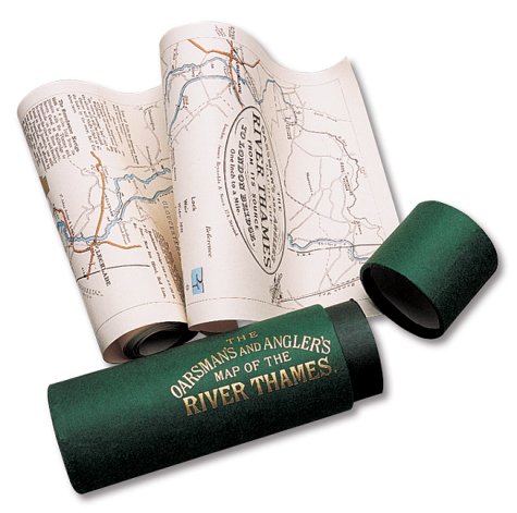
Explore Britain's best loved waterway with the map that must surely have been used by the Three Men in a Boat. Very detailed, one inch to the mile and over 8 feet in length, it shows all 164 miles from the source to London. Riverside towns and villages are marked with historical information and details of the locks and how to operate them. For fishermen, the best pools where trout, pike, perch and others were to be found. There are also details of toll charges and angling laws and a description of life on the river over a century ago when the Thames was the nation's favourite place for recreation and sport. The map is scrolled in a gold blocked presentation tube.
"Sobre este tĒtulo" puede pertenecer a otra edici¾n de este libro.
- EditorialShire Publications
- A±o de publicaci¾n1991
- ISBN 10 1873590024
- ISBN 13 9781873590027
- Encuadernaci¾nMapa
- N·mero de pßginas1
(Ning·n ejemplar disponible)
Buscar: Crear una petici¾nSi conoce el autor y el tĒtulo del libro pero no lo encuentra en IberLibro, nosotros podemos buscarlo por usted e informarle por e-mail en cuanto el libro estķ disponible en nuestras pßginas web.
Crear una petici¾n