ArtĒculos relacionados a London Street Atlas (A-Z Street Atlas)

Rese±a del editor:
A-Z are proud to publish this edition of the famous A-Z London Street Atlas in partnership with London's Air Ambulance (registered charity 801013). Everyone's a Londoner when they are in London and with 10% of the profit of this item being donated when sold*, you will be helping to support this essential service deliver an advanced trauma team to critically injured people in the Capital.
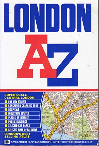
This publication has 155 pages of our standard street mapping at a scale of 2.88 inches to 1 mile, extending to:
- Barnet
- Chingford
- Dagenham
- Sidcup
- Chislehurst
- Farnborough
- Croydon
- Surbiton
- Shepperton
- Heathrow Airport (Terminals 1-5)
- Ruislip
- Stanmore
A large-scale Central London 16 page street map section at 5.75 inches to 1 mile, extending:
- north to Regent's Park and Shoreditch
- south to Chelsea and Vauxhall
- west to Hyde Park
- east to Bermondsey.
Also included is:
- An overview map of the Congestion Charging Zone
- A West End Theatre map
- The London Connections rail services map
- The full London Underground map
Postcode districts, one-way streets, safety camera locations with maximum speed limits and the Congestion Charging Zone are also featured on the mapping.
The comprehensive index lists streets, selected flats, walkways and places of interest, place, area and junction names. There are separate index listings for both hospitals, walk-in centres and hospices and for the National Rail, London Tramlink, Docklands Light Railway, London Underground and Overground stations, and River Bus piers covered by this atlas.
*Up to a maximum of Ż10,000
"Sobre este tĒtulo" puede pertenecer a otra edici¾n de este libro.
- EditorialGeographers' A-Z Map Co Ltd
- A±o de publicaci¾n2012
- ISBN 10 1843488833
- ISBN 13 9781843488835
- Encuadernaci¾nTapa blanda
- N·mero de pßginas464
- Valoraci¾n
Comprar nuevo
Ver este artĒculo
EUR 49,80
Gastos de envĒo:
EUR 3,70
A Estados Unidos de America
Los mejores resultados en AbeBooks
Imagen de archivo
London Street Atlas (A-Z Street Atlas) 2015
Publicado por
Geographers' A-Z Map Co Ltd
(2015)
ISBN 10: 1843488833
ISBN 13: 9781843488835
Nuevo
Paperback
Cantidad disponible: 1
Librería:
Valoraci¾n
Descripci¾n Paperback. Condici¾n: new. New. Fast Shipping and good customer service. N║ de ref. del artĒculo: Holz_New_1843488833
Comprar nuevo
EUR 49,80
Convertir moneda
Imagen de archivo
London Street Atlas (A-Z Street Atlas) 2015
Publicado por
Geographers' A-Z Map Co Ltd
(2015)
ISBN 10: 1843488833
ISBN 13: 9781843488835
Nuevo
Paperback
Cantidad disponible: 1
Librería:
Valoraci¾n
Descripci¾n Paperback. Condici¾n: new. Brand New Copy. N║ de ref. del artĒculo: BBB_new1843488833
Comprar nuevo
EUR 64,16
Convertir moneda
Imagen de archivo
London Street Atlas (A-Z Street Atlas) 2015
Publicado por
Geographers' A-Z Map Co Ltd
(2015)
ISBN 10: 1843488833
ISBN 13: 9781843488835
Nuevo
Paperback
Cantidad disponible: 1
Librería:
Valoraci¾n
Descripci¾n Paperback. Condici¾n: new. Buy for Great customer experience. N║ de ref. del artĒculo: GoldenDragon1843488833
Comprar nuevo
EUR 64,03
Convertir moneda
Imagen de archivo
London Street Atlas (A-Z Street Atlas) 2015
Publicado por
Geographers' A-Z Map Co Ltd
(2015)
ISBN 10: 1843488833
ISBN 13: 9781843488835
Nuevo
Tapa blanda
Cantidad disponible: 1
Librería:
Valoraci¾n
Descripci¾n Condici¾n: new. N║ de ref. del artĒculo: FrontCover1843488833
Comprar nuevo
EUR 63,24
Convertir moneda
Imagen de archivo
London Street Atlas (A-Z Street Atlas) 2015
Publicado por
Geographers' A-Z Map Co Ltd
(2015)
ISBN 10: 1843488833
ISBN 13: 9781843488835
Nuevo
Paperback
Cantidad disponible: 1
Librería:
Valoraci¾n
Descripci¾n Paperback. Condici¾n: new. New Copy. Customer Service Guaranteed. N║ de ref. del artĒculo: think1843488833
Comprar nuevo
EUR 65,91
Convertir moneda
Imagen de archivo
London Street Atlas (A-Z Street Atlas) 2015
Publicado por
Geographers' A-Z Map Co Ltd
(2015)
ISBN 10: 1843488833
ISBN 13: 9781843488835
Nuevo
Paperback
Cantidad disponible: 1
Librería:
Valoraci¾n
Descripci¾n Paperback. Condici¾n: new. New. N║ de ref. del artĒculo: Wizard1843488833
Comprar nuevo
EUR 66,68
Convertir moneda