Artículos relacionados a Texas Land Survey Maps for Foard County

Reseńa del editor:
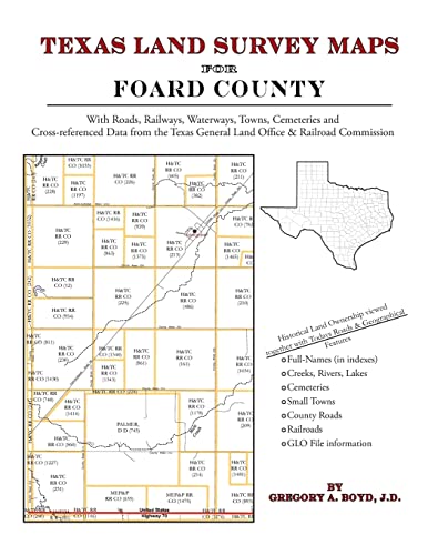
190 pages with 49 maps An indispensable book for any researcher interested in Foard County's history or land (or both), or its first landowners after Texas's Independence from Mexico. Each book in this series is laid out into multiple maps using a 6 mile high by 4 mile wide grid.This book contains 44 Survey maps laid out within this grid. Each Land Survey Map shows the boundaries of original parcels laid out over existing roads, railroads, waterways. These are shown as well as the original Survey-Name and the Abstract Number assigned by the Texas General Land Office to the instrument that gave ownership to that parcel. Here are a number of details about our Foard County book . . . Supplemental Maps Included (in addition to the primary Survey Maps) . . . - Where Foard County Lies Within the State (Map A) - Foard County and its Surrounding Counties (Map B) - An Index Map showing where each of the Land Survey Maps are within Foard County (Map C) - An Index Map that builds upon Map C and shows the community-center points in relationship to the county-grid (Map D) - An Index Map that builds upon Map C and shows cemeteries listed in the USGS database in relationship to the county-grid (Map E) Primary Indexes (apart from each Survey-Map's own index of survey-names) - An All-Name Index (alphabetical by last-name) for every person mentioned in the maps, utilizing both Texas General Land Office and Texas Railroad Commission data. - The Abstract Listing: this is where you find the real details behind each parcel of land.Items are listed by Abstract Number What Cities and Towns are in Foard County, Texas (and in this book)? Crowell, Foard City, Margaret, Rayland, Thalia, Vivian, Vivian
"Sobre este título" puede pertenecer a otra edición de este libro.
- EditorialArphax Publishing Co.
- Ańo de publicación2010
- ISBN 10 1420350528
- ISBN 13 9781420350524
- EncuadernaciónTapa blanda
- Número de páginas200
Comprar nuevo
Ver este artículo
EUR 26,06
Gastos de envío:
EUR 3,69
A Estados Unidos de America
Los mejores resultados en AbeBooks
Imagen de archivo
Texas Land Survey Maps for Foard County
Publicado por
Arphax Publishing Co.
(2010)
ISBN 10: 1420350528
ISBN 13: 9781420350524
Nuevo
Tapa blanda
Cantidad disponible: > 20
Librería:
Valoración
Descripción Condición: New. Nş de ref. del artículo: ABLIING23Mar2411530198466
Comprar nuevo
EUR 26,06
Convertir moneda
Imagen de archivo
Texas Land Survey Maps for Foard County
Publicado por
Arphax Publishing Co.
(2010)
ISBN 10: 1420350528
ISBN 13: 9781420350524
Nuevo
Paperback / softback
Cantidad disponible: > 20
Librería:
Valoración
Descripción Paperback / softback. Condición: New. This item is printed on demand. New copy - Usually dispatched within 5-9 working days. Nş de ref. del artículo: C9781420350524
Comprar nuevo
EUR 39,45
Convertir moneda
Gastos de envío:
EUR 10,51
De Reino Unido a Estados Unidos de America
Destinos, gastos y plazos de envío