ArtĒculos relacionados a Medieval Maps of the Holy Land

Medieval maps of the holy land editado por The British Library Pub.
"Sinopsis" puede pertenecer a otra edici¾n de este libro.
CrĒticas:
"[C]ogently organized, richly illustrated . . . and pithily written, offering nothing less than a journey to the centre of the earth, as it was once conceived."--Anthony Bale "Times Literary Supplement " "The latest publication from a prolific contributor to the history of maps, Harvey's tome provides an important source of the cartographic depiction of the Holy Land's medieval period, a much-neglected area of research. . . . The analysis of the book's thirteen short, chronologically arranged chapters is full of detail and valuable insights. Recommended."--L. Yacher, Southern Connecticut State University "Choice " [C]ogently organized, richly illustrated . . . and pithily written, offering nothing less than a journey to the centre of the earth, as it was once conceived. --Anthony Bale "Times Literary Supplement "" The latest publication from a prolific contributor to the history of maps, Harvey s tome provides an important source of the cartographic depiction of the Holy Land s medieval period, a much-neglected area of research. . . . The analysis of the book s thirteen short, chronologically arranged chapters is full of detail and valuable insights. Recommended. --L. Yacher, Southern Connecticut State University "Choice ""
Rese±a del editor:
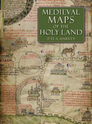
Neglected since the 1890s, the eight medieval regional maps of the Holy Land that are known to have existed are interesting, picturesque and mostly colourful. Many of the surviving copies and fragments are reproduced here for the first time, including three large maps that are among medieval Europe's finest cartographic monuments. Painstaking detective work on the manuscripts reveals much that is new: two maps lurking behind others drawn over them, a map changed into an erotic fantasy by a nineteenth-century forger, the origin of the mysterious grid pattern on some of the maps and much else. This beautifully produced large-format book is an important contribution to our understanding of medieval culture, early mapping and crusading Europe.
"Sobre este tĒtulo" puede pertenecer a otra edici¾n de este libro.
- EditorialThe British Library Publishing Division
- A±o de publicaci¾n2012
- ISBN 10 0712358242
- ISBN 13 9780712358248
- Encuadernaci¾nTapa dura
- N·mero de edici¾n1
- N·mero de pßginas208
- Valoraci¾n
Comprar nuevo
Ver este artĒculo
EUR 83,54
Gastos de envĒo:
EUR 3,75
A Estados Unidos de America
Los mejores resultados en AbeBooks
Imagen de archivo
Medieval Maps of the Holy Land
Publicado por
British Library
(2012)
ISBN 10: 0712358242
ISBN 13: 9780712358248
Nuevo
Tapa dura
Cantidad disponible: 1
Librería:
Valoraci¾n
Descripci¾n Condici¾n: New. 2012. 0th Edition. Hardcover. New. N║ de ref. del artĒculo: PIE0001644
Comprar nuevo
EUR 83,54
Convertir moneda
Imagen de archivo
Medieval Maps of the Holy Land
Publicado por
British Library
(2012)
ISBN 10: 0712358242
ISBN 13: 9780712358248
Nuevo
Tapa dura
Cantidad disponible: 1
Librería:
Valoraci¾n
Descripci¾n Hardcover. Condici¾n: new. New. Fast Shipping and good customer service. N║ de ref. del artĒculo: Holz_New_0712358242
Comprar nuevo
EUR 93,40
Convertir moneda
Imagen de archivo
Medieval Maps of the Holy Land
Publicado por
British Library, London
(2012)
ISBN 10: 0712358242
ISBN 13: 9780712358248
Nuevo
Tapa dura
Original o primera edici¾n
Cantidad disponible: 1
Librería:
Valoraci¾n
Descripci¾n Hardcover. Condici¾n: New. Estado de la sobrecubierta: New. First Edition. London: British Library, 2012. First edition. Folio. Hard cover binding, 160 pp. Illustrated throughout in color. This study examines the eight known medieval regional maps of the Holy Land. Interesting, picturesque, and often colorful, these maps provide great insight into how the Holy Land was perceived by Western Europe in the age of the Crusades. Many of the surviving copies and fragments from the period are reproduced here for the first time, including three large maps that are among medieval Europe?s finest cartographic monuments. In the course of this study P. D. A. Harvey, a leading historian of medieval maps, undertook detailed detective work that revealed many new discoveries, such as two maps hidden behind newer renditions, a map that was transformed into an erotic fantasy by a nineteenth-century forger, and information about the origin of a mysterious grid pattern on some of the maps. The research and illustrations presented in Medieval Maps of the Holy Land constitute an important contribution to the studies of medieval culture, early mapping, and crusading Europe. New in new dust jacket, protected with an archival-quality mylar cover. N║ de ref. del artĒculo: 020433
Comprar nuevo
EUR 91,74
Convertir moneda
Imagen de archivo
Medieval Maps of the Holy Land
Publicado por
British Library
(2012)
ISBN 10: 0712358242
ISBN 13: 9780712358248
Nuevo
Tapa dura
Cantidad disponible: 1
Librería:
Valoraci¾n
Descripci¾n Hardcover. Condici¾n: new. New Copy. Customer Service Guaranteed. N║ de ref. del artĒculo: think0712358242
Comprar nuevo
EUR 119,12
Convertir moneda
Imagen de archivo
Medieval Maps of the Holy Land
Publicado por
British Library
(2012)
ISBN 10: 0712358242
ISBN 13: 9780712358248
Nuevo
Tapa dura
Cantidad disponible: 1
Librería:
Valoraci¾n
Descripci¾n Condici¾n: New. Buy with confidence! Book is in new, never-used condition. N║ de ref. del artĒculo: bk0712358242xvz189zvxnew
Comprar nuevo
EUR 123,17
Convertir moneda
Imagen de archivo
Medieval Maps of the Holy Land
Publicado por
British Library
(2012)
ISBN 10: 0712358242
ISBN 13: 9780712358248
Nuevo
Tapa dura
Cantidad disponible: 1
Librería:
Valoraci¾n
Descripci¾n Hardcover. Condici¾n: New. New. book. N║ de ref. del artĒculo: D7S9-1-M-0712358242-6
Comprar nuevo
EUR 220,37
Convertir moneda
Gastos de envĒo:
EUR 29,27
De Reino Unido a Estados Unidos de America
Destinos, gastos y plazos de envĒo