Artículos relacionados a Railway Atlas Then and Now 2nd edition

Críticas:
This new book will delight historians, geographers, cartographers and railway buffs alike. At Ł19.99 it is a bargain, covering every section of England, Scotland and Wales with comprehensive liner notes explaining the colour coding and numbering. It is an invaluable reference for anyone touring or even staying in a single place becuase it also pinpoints all the preserved heritage lines open to the general public. --Evergreen Magazine
Reseńa del editor:
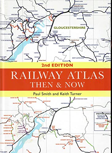
There is an undoubted fascination both with railway atlases and with the 'Then & Now' comparative approach to railway history. First published in 2012, the Railway Atlas Then and Now provides historical and present-day maps alongside each other for direct comparison. Based around the Pre-Grouping Atlas and Gazetteer, the left-hand of the two maps records the railway industry as it existed in 1923, whilst the right-hand page shows it as it exists today. The contemporary maps include information about the railway lines that have been closed and converted into either walking or cycling routes. Other information given includes the location of all steam sheds and current diesel depots. The book includes 45 maps from each period - making a total of 90pp of mapping in all - alongside a detailed gazetteer and brief introduction. This edition has been completely updated to show the complete railway network in Britain in 2015 in the 'Now' maps. The maps will be enlarged slightly to make them clearer and easier to read and the authors have also added a list of all stations that opened and closed between the 1923 Grouping and the present day.
"Sobre este título" puede pertenecer a otra edición de este libro.
- EditorialIan Allan Publishing
- Ańo de publicación2015
- ISBN 10 0711038333
- ISBN 13 9780711038332
- EncuadernaciónTapa dura
- Número de edición2
- Número de páginas120
- Valoración
Comprar nuevo
Ver este artículo
EUR 18,04
Gastos de envío:
EUR 15,18
De Reino Unido a Estados Unidos de America
Los mejores resultados en AbeBooks
Imagen de archivo
RAILWAY ATLAS THEN & NOW : Second Edition
Publicado por
Ian Allan Publishing, Addlestone
(2015)
ISBN 10: 0711038333
ISBN 13: 9780711038332
Nuevo
Tapa dura
Cantidad disponible: 1
Librería:
Valoración
Descripción Hardcover. Condición: New. 2nd Edition. This mint copy is bound in illustrated laminated boards, A dust wrapper is not called for. The text block is unmarked, tight, white, bright and square. International postal rates are calculated on a book weighing 1 Kilo, in cases where the book weighs more than 1 Kilo increased postal rates will be quoted, where the book weighs less then postage will be reduced accordingly. There is an undoubted fascination both with railway atlases and with the 'Then & Now' comparative approach to railway history. First published in 2012, the Railway Atlas Then and Now provides historical and present-day maps alongside each other for direct comparison. Based around the Pre-Grouping Atlas and Gazetteer, the left-hand of the two maps records the railway industry as it existed in 1923, whilst the right-hand page shows it as it exists today. The contemporary maps include information about the railway lines that have been closed and converted into either walking or cycling routes. Other information given includes the location of all steam sheds and current diesel depots. The book includes 45 maps from each period - making a total of 90pp of mapping in all - alongside a detailed gazetteer and brief introduction. This edition has been completely updated to show the complete railway network in Britain in 2015 in the 'Now' maps. The maps will be enlarged slightly to make them clearer and easier to read and the authors have also added a list of all stations that opened and closed between the 1923 Grouping and the present day. Ref FCC. Nş de ref. del artículo: 028024
Comprar nuevo
EUR 18,04
Convertir moneda
Gastos de envío:
EUR 15,18
De Reino Unido a Estados Unidos de America
Destinos, gastos y plazos de envío