Artículos relacionados a Big London Street Atlas

Reseńa del editor:
Contraportada:
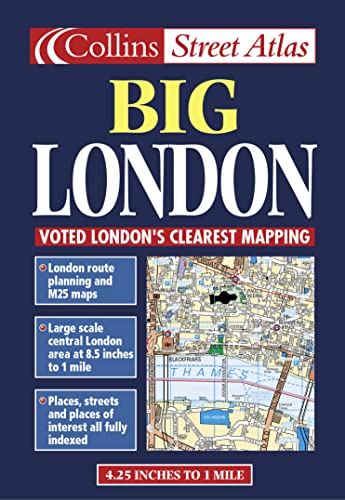
1:15,000 4.2 inches to 1 mile Central London at 8.4 inches to 1 mile (1:15000) This atlas is ideal for the driver in central london. The large scale and high level of detail make it an essential purchase.
MAIN FEATURES
· Large scale full colour mapping
· Extensive area of coverage
· Extra large scale central London section
· Large format
· Includes London & M25 route planning maps
INCLUDES
· Index to places of interest
· Full index to street names
· CIear colour-coded roads and buildings
AREA OF COVERAGE
Extends from Heathrow in the west to Barking in the east, and from Edmonton in the north to Beckenham in the south.
WHO THE PRODUCT IS AIMED AT
Especially useful for businesses and drivers.
OTHER PRODUCTS IN THE SERIES
Collins publish a wide range of London mapping in a variety of scales and formats.
Large-scale central London mapping showing a variety of driving and parking information including 24 hour petrol stations and red routes. Full street index and index to place names.
Scale: Central London 1: 7 500 (8.4 inches: 1 mile)
Outer London 1: 15 000 (4.2 inches; 1 mile)
"Sobre este título" puede pertenecer a otra edición de este libro.
- EditorialCollins
- Ańo de publicación1999
- ISBN 10 0004488342
- ISBN 13 9780004488349
- EncuadernaciónTapa blanda
- Número de páginas104

EUR 4,07
Gastos de envío:
EUR 9,00
De Alemania a Estados Unidos de America
Los mejores resultados en AbeBooks
Imagen de archivo
Big London Street Atlas
Publicado por
Harper Collins
(2000)
ISBN 10: 0004488342
ISBN 13: 9780004488349
Antiguo o usado
Tapa blanda
Cantidad disponible: 1
Librería:
Valoración
Descripción Condición: very good. Gut/Very good: Buch bzw. Schutzumschlag mit wenigen Gebrauchsspuren an Einband, Schutzumschlag oder Seiten. / Describes a book or dust jacket that does show some signs of wear on either the binding, dust jacket or pages. Nş de ref. del artículo: M00004488342-V
Comprar usado
EUR 4,07
Convertir moneda
Gastos de envío:
EUR 9,00
De Alemania a Estados Unidos de America
Destinos, gastos y plazos de envío
Imagen de archivo
London Big Street Atlas Collins (STREET & STREEF)
Publicado por
Harper Collins
(2000)
ISBN 10: 0004488342
ISBN 13: 9780004488349
Antiguo o usado
Tapa blanda
Cantidad disponible: 1
Librería:
Valoración
Descripción Condición: Very Good. 1710245849. 3/12/2024 12:17:29 PM. Nş de ref. del artículo: U9780004488349
Comprar usado
EUR 7,40
Convertir moneda
Gastos de envío:
EUR 6,45
De Reino Unido a Estados Unidos de America
Destinos, gastos y plazos de envío
Imagen de archivo
London Big Street Atlas Collins
Publicado por
Harper Collins, London
(2000)
ISBN 10: 0004488342
ISBN 13: 9780004488349
Antiguo o usado
Map
Cantidad disponible: 1
Librería:
Valoración
Descripción Map. Condición: Near Fine. "Features Nicholson mapping"--Cover. Mapping copyright by Bartholomew Ltd. 1999. At head of title: Collins. Includes indexes to place names, street na mes, and places of interest. Map Data: Scale 1:15,000. 4.25 in. to 1 mile. Scale 1:7,500. 8.5 in. to 1 mile. Coordinates: a 15000 a 7500. Nş de ref. del artículo: RWARE0000020627
Comprar usado
EUR 8,92
Convertir moneda