Artículos relacionados a Southern Scotland and Northumberland: Sheet 3 (Road...
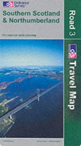
Southern Scotland and Northumberland: Sheet 3 (Road Map)

 
9780319230602: Southern Scotland and Northumberland: Sheet 3 (Road Map)
Ver todas las copias de esta edición ISBN.
 
 
Cover creased and worn, map unmarked. Shipped from the U.K. All orders received before 3pm sent that weekday.

"Sinopsis" puede pertenecer a otra edición de este libro.

Reseña del editor:
The eight maps in this series, released in May 2001 by the Ordnance Survey, are designed to include everything a driver needs to explore the country. A journey can be planned in advance, making full use of the colour-coded roads, restricted motorway junctions and mileage guides. They even include height and steep gradient information, making them ideal not only for motorists but also for long distance cyclists and caravanners. From major cities to small villages, each map features a unique gazetteer inside the cover to simplify the task of finding your destination. Tourist information is also included for day trippers and holiday makers including Caravan sites, historic buildings, gardens and country parks, themes and much more.

"Sobre este título" puede pertenecer a otra edición de este libro.

  • EditorialOrdnance Survey
  • Año de publicación2003
  • ISBN 10 0319230600
  • ISBN 13 9780319230602
  • EncuadernaciónMapa
  • Número de páginas8

Comprar usado

Condición: Regular
A readable copy of the book which... Ver este artículo

Gastos de envío: EUR 5,59
De Reino Unido a Estados Unidos de America

Destinos, gastos y plazos de envío

Añadir al carrito

Los mejores resultados en AbeBooks

Imagen de archivo

Ordnance Survey
Publicado por Ordnance Survey (2003)
ISBN 10: 0319230600 ISBN 13: 9780319230602
Antiguo o usado Paperback Cantidad disponible: 2
Librería:
WorldofBooks
(Goring-By-Sea, WS, Reino Unido)

Descripción Paperback. Condición: Fair. A readable copy of the book which may include some defects such as highlighting and notes. Cover and pages may be creased and show discolouration. Nº de ref. del artículo: GOR005415522

Más información sobre este vendedor | Contactar al vendedor

Comprar usado
EUR 8,39
Convertir moneda

Añadir al carrito

Gastos de envío: EUR 5,59
De Reino Unido a Estados Unidos de America
Destinos, gastos y plazos de envío
Imagen de archivo

Ordnance Survey
ISBN 10: 0319230600 ISBN 13: 9780319230602
Antiguo o usado Paperback Cantidad disponible: 3
Librería:
WorldofBooks
(Goring-By-Sea, WS, Reino Unido)

Descripción Paperback. Condición: Very Good. The eight maps in this series, released in May 2001 by the Ordnance Survey, are designed to include everything a driver needs to explore the country. A journey can be planned in advance, making full use of the colour-coded roads, restricted motorway junctions and mileage guides. They even include height and steep gradient information, making them ideal not only for motorists but also for long distance cyclists and caravanners. From major cities to small villages, each map features a unique gazetteer inside the cover to simplify the task of finding your destination. Tourist information is also included for day trippers and holiday makers including Caravan sites, historic buildings, gardens and country parks, themes and much more. The book has been read, but is in excellent condition. Pages are intact and not marred by notes or highlighting. The spine remains undamaged. Nº de ref. del artículo: GOR004792875

Más información sobre este vendedor | Contactar al vendedor

Comprar usado
EUR 16,76
Convertir moneda

Añadir al carrito

Gastos de envío: EUR 5,59
De Reino Unido a Estados Unidos de America
Destinos, gastos y plazos de envío
Imagen de archivo

Ordnance Survey
Publicado por Ordnance Survey (2003)
ISBN 10: 0319230600 ISBN 13: 9780319230602
Antiguo o usado Cantidad disponible: 1
Librería:
SecondSale
(Montgomery, IL, Estados Unidos de America)

Descripción Condición: Good. Item in good condition. Textbooks may not include supplemental items i.e. CDs, access codes etc. Nº de ref. del artículo: 00049463499

Más información sobre este vendedor | Contactar al vendedor

Comprar usado
EUR 31,24
Convertir moneda

Añadir al carrito

Gastos de envío: GRATIS
A Estados Unidos de America
Destinos, gastos y plazos de envío
Imagen de archivo

Ordnance Survey
Publicado por Ordnance Survey (2003)
ISBN 10: 0319230600 ISBN 13: 9780319230602
Antiguo o usado Original o primera edición Cantidad disponible: 1
Librería:
John Sanders
(Holsworthy, DEV, Reino Unido)

Descripción No Binding. Condición: Very Good. No Jacket. 1st Edition. The cover has only very light edge wear. The map is sound with no markings or inscriptions. Sent within 24 hours. Ref: BK1371. Nº de ref. del artículo: JSB-BK-1371

Más información sobre este vendedor | Contactar al vendedor

Comprar usado
EUR 7,18
Convertir moneda

Añadir al carrito

Gastos de envío: EUR 39,27
De Reino Unido a Estados Unidos de America
Destinos, gastos y plazos de envío