Descripción
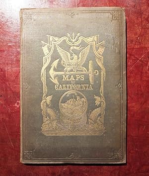
RINGGOLD, Cadwalader (1802-1867). A Series of Charts, with Sailing Directions, Embracing Surveys of the Farallones, entrance to the Bay of San Francisco, Bays of San Francisco and San Pablo, Straits of Carquines and Suisan Bay, Confluence and Deltic Branches of the Sacramento and San Joaquin Rivers, and the Sacramento River (with the middle fork) to the American River, including the Cities of Sacramento and Boston, State of California. Washington: Jno. T. Towers, 1852. 4to., (11 x 7 4/8 inches). Lithographed frontispiece and 10 further plates with tinted grounds by William H. Dougal (some occasional spotting), six exceptionally fine folding lithographed charts (last chart with short tear near the mount). Original green pictorial cloth, gilt (unevenly faded, scuffed at extremities, inner hinges strengthened); preserved in a marbled paper boards slipcase and chemise. Provenance: with John Howell-Books at Parke-Bernet, 10/69; from the important cartographical library of Warren Heckrotte, part II, his sale, Rare Cartography, Exploration and Voyages, 3rd December, 2015, lot 57 "The surveys and charts. may be fairly and fully tested, by intelligent practical navigators." (Ringgold, from "The Preface"). Fourth edition, with additions. Warren Heckrotte comments: "The views in the fourth edition are the same as in the first edition with plates, but are arranged differently; Streeter says that the views in the first edition with plates are the best, but based on a comparison, there is no basis for that statement". First published in 1851 without plates or maps, and so popular that five editions were published by the following year in 1852. "During the years 1849 and 1850, when the tide of emigration was beyond all example, and when the magnificent expanse of waters groaned under the weight of commerce, the anchorage of San Francisco crowed with richly laden ships, all eager to transport their valuable cargoes to the mining region through the unexplored mazes of extensive bays and rivers, and while thousands of human beings were anxiously flocking thither, often in open boats, ill suited to the exposed navigation leading to the interior, the enterprising citizens of San Francisco, in the face of these embarrassments, and in the absence of any authentic charts, saw the necessity of careful and immediate surveys" (Ringgold "Preface"). The fine views include: "View of Sacramento City from the west bank"; "Entrance to San Francisco"; "View of San Francisco from Yerba Buena Island": "View of Monte Diablo from Garnet Island"; "View of Benicia from the Anchorage East of Seal Island"; "View of Monte Diablo from Forks of the Sacramento"; "Entrance to the Sacramento River"; "Mark for Invincible Buoy Point Smith, east of Angel I. on with Signal Hill" and "Mark for Invincible Buoy North extreme of Marin Is. on with clump of trees north of San Rafael", on one plate; "Mark for Tongue Shoal"; "Mark for entering the second section of the Middle Fork of the Sacramento River". "Mark for entering the Sacramento and its Forks at their confluence". The maps include: "General Chart Embracing Surveys of the Farallones Entrance to the Bay of San Francisco Bays of San Francisco and San Pablo Straits of Carquines and Suisun Bay and the Sacramento and San Joaquin Rivers to the Cities of Sacramento and San Joaquin California"; "Chart of the Farallones and Entrance to the Bay of San Francisco California"; "Chart of the Bay of San Pablo Straits of Carquines and part of the Bay of San Francisco California"; "Chart of Suisun & Vallejo Bays with the Confluence of the Rivers Sacramento and San Joaquin California"; "Chart of the Sacramento River from Suisun City to the American River California"; Six charts on one sheet: Straits of Carquines and Vallejo Bay by Cadwalader Ringgold, U. S. N. 1850.;Depot of the Pacific Mail Steam Company Benicia; Anchorage off Sacramento City; Anchorage off New York of the Pacific; Anchorage off San Francisco; Vallejo and Mare Island Strait. N° de ref. del artículo 72lib1399
Contactar al vendedor
Denunciar este artículo
![]()


