Descripción
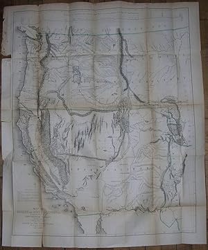
FREMONT, John Charles (1813-1890). Geographical Memoir upon Upper California in Illustration of his Map of Oregon and California. Washington: Tippin & Streeper, 1849. 8vo., (8 4/8 x 5 4/8 inches). Folded lithographic map with original hand-color in outline: "Map of Oregon and Upper California from the Surveys of John Charles Frémont and other Authorities. Drawn By Charles Preuss under the Order of the Senate of the United States Washington City 1848" (35 4/8 x 29 4/8 inches) (detached, browned with some separations at folds). ONE OF THE EARLIEST GRAPHIC ANNOUNCEMENTS OF THE DISCOVERY OF GOLD IN CALIFORNIA First edition, the House issue, of the report of Frémont's third expedition, with the large-scale map rather than the smaller quadrant map. "One of the seminal maps in the history of California exploration and settlement, the Frémont-Preuss map of 1848 is the last of four major cartographic works documenting Lieut. John C. Frémont's two pioneering trans-Mississippi exploration expeditions to Oregon and Northern California in 1843-44 and to the Great Basin and Californian 1844-46. It provides the first depiction of the California region based on scientific topographic surveys, notably expanding contemporary geographic knowledge of the Sierra Nevada and Coast Ranges, and the drainage pattern of the Sacramento and San Joaquin valleys. Published on the eve of the California Gold Rush and statehood, this map also served as a powerful political document that promoted the prevailing American concept of the Manifest Destiny. It was one of the first maps to depict the creation of the Territory of Oregon and the establishment of the Mexican-United States boundary, which was ratified on July 4,1848; the first widely circulated map to announce the location of the discovery of gold deposits along the American and Feather rivers; and it introduced or perpetuated numerous California place names including Kern River, Walker Pass, Owens Lake, and the 'inspired' term, Golden Gate, designating the entrance to San Francisco Bay" (Ehrenberg). Ehrenberg , "California 49: Forty-Nine Maps of California from the Sixteenth Century to the Present" 27:Howes F366; Sabin 25837; Schwartz & Ehrenberg, The Mapping of America, plate 171, p. 278; Wheat, "Books of the California Gold Rush" 78. N° de ref. del artículo 72map316
Contactar al vendedor
Denunciar este artículo
![]()
