Descripción
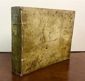
Oblong 4to., (6 4/8 x 8 5/8 inches). Engraved allegorical title-page (laid down), engraved allegorical plate, 149 (of 152) fine engraved maps, four of the Italian maps with later hand-colouring in outline, all with letterpress headline titles, printed on rectos with text on versos, woodcut initials (without maps 149 "Designatio orbis Christianis", 151 "Romani Imperii imag" and 152 " Alexandri Magni expeditio, one text leaf at the end, some early repairs to versos, map 146 "Topographia Paradisi" a bit stained and frayed). 17th- or 18th-century English reverse blind panelled calf ( a bit worn at the extremities). Provenance: with the ownership inscriptions and notes of Nicholas Pottinger dated 1642 and 1672 on the front free endpaper, and his table at the end including a list of "Peoples & Places of note whereto be found"; the early initials of "MF" on the front free endpaper; late 18th or early 19th-century ownership inscription of Philip Griffin, Warnford, Hampshire on the fifth blank, with his manuscript numbering to maps and interleaved; the modern bookplate of Lionel H. Pries on the front paste-down. First edition, and rare, of the Hondius-Mercator pocket atlas, and intended as a reduced version of Gerard Mercator's folio atlas "Atlas sive Cosmographia", 1606. Copies often show signs of rushed printing, with inserts or pasted-down leaves correcting impressions of the wrong copperplates: in this copy the maps of Morea (122) and Egypt (125) are correctly printed (unlike the copy described by Koeman), but map 58 was printed in duplicate, and map 54 printed on the wrong page. A second impression of map 58 "Lyonnois Forest et Beaujolais" misprinted on Ii4 in place of map 54 "Lotaringia septentrionale)", map 54 misprinted on Kk2 in place of map 55 "Lotaringia meridiona", a correct impression of map 55 supplied on an inserted leaf facing Ii4. This smaller atlas was a huge success for Hondius and his partners Cornelius Claesz and Johannes Janssonius, and editions were published not only in Latin, but also in French, Dutch, German and eventually in Russian, Turkish and English. Including a fine double-hemisphere world map "Typus Orbis Terrarum", "America", "Polus Arcticus", "Hispania Nova", "Virginia & Florida", "Cuba", "America Meridionalis", and "Fretum Magellanicum" relating to America. Koeman II Me 186. Catalogued by Kate Hunter. N° de ref. del artículo 72lib267
Contactar al vendedor
Denunciar este artículo
![]()

