Descripción
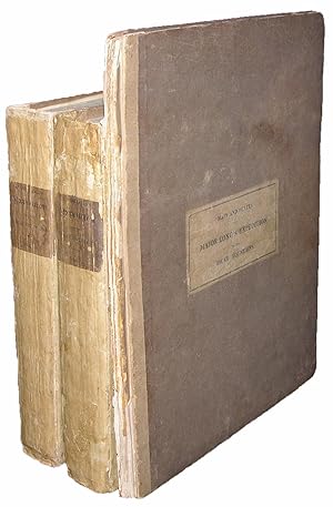
"3 volumes. 8vo., (text volumes: 10 x 6 1/8 inches; atlas volume: 12 x 9 ½ inches). (A bit spotted throughout). 2 fine double-page engraved maps after S. H. Long by Young & Delleker; double-page engraved geological cross-section; 8 engraved plates (including one hand-colored). Uniformly bound in publisher's original drab paper boards, with printed paper labels on the front cover of the atlas and on the spines of each text volume (atlas volume backstrip worn away, text volumes expertly rebacked, preserving most of the spine); the text volumes preserved in modern morocco-backed blue cloth slipcase and chemises. Provenance: With the bookplate of Charles Brown Voorhis (1870-1961), dated 11-10-24, to the front pastedown of volume one. First edition. Major Stephen Harriman Long (1784-1864), considered himself to be the natural successor to Lewis and Clark. His expedition into the trans-Mississippi West was the first to be accompanied by artists, and as such the accompanying atlas is of enormous importance: including not only detailed maps, but images of Native American encampments, rituals and artifacts, as well as views of the Great Plains. During 1816 and 1817 "he crisscrossed Illinois, Iowa, Indiana, and Missouri, examining army garrisons and gathering general scientific data about the region. In 1817 he led a small party up the Mississippi River to the site of Minneapolis, where he dealt with the Indians and sought future sites for military posts. During the winter of 1817-1818 he traveled up the Arkansas River, choosing the site for what became Fort Smith, Arkansas. Later in 1818 Secretary of War John C. Calhoun decided to have Long organize and lead a scientific expedition up the Missouri River to the Rocky Mountains. He ordered the major to Pittsburgh, where Long designed and supervised the construction of a steamboat, the 'Western Engineer,' that was to carry the scientists west. On 5 May 1819 the 'Western Engineer' began its journey down the Ohio River to St. Louis. Long had assembled an impressive group of scientists for the expedition, including William Baldwin, Titian R. Peale, Thomas Say, and Samuel Seymour. Despite their long-awaited start, trouble with the steamboat design and machinery, a lack of efficient fuel, and the muddy Missouri River water all combined to slow the boat. Frequent breakdowns hindered upriver progress so that when the scientists halted near present Omaha, Nebraska, in September 1819, they had fallen far short of earlier expectations. As a result, the War Department ended its effort to explore the western rivers by steamboat. "The following summer Long and a much-reduced party of soldiers and scientists set out to explore the central plains. Drought, lack of horses, an inadequate supply of food, and faulty maps caused the explorers much difficulty. They traveled west to the Rocky Mountains and then south to the Arkansas River. There half of the party turned east while Long led the rest south in search of the headwaters of the Red River. They hunted in vain, and having depleted their food and water, they headed east along one of the branches of the Canadian River, having failed to locate the Red. The scientists dispersed at Fort Smith as they returned east. Long's negative description of the central plains as the Great American Desert appeared on maps for the next generation. The explorers published their findings in the three-volume 'Account of an Expedition from Pittsburgh to the Rocky Mountains…' (1823), compiled by Edwin James [as here]" (Roger L. Nichols for ANB). The Long Expedition was the third major American exploration into the trans-Mississippi West, following those of Lewis and Clark, and Pike, and much was expected of him: "The object of the Expedition, is to acquire as thorough and accurate knowledge as may be practicable, of a portion of our country, which is daily becoming more interesting. You will permit nothing worthy of notice, to escape your attention. Ascertain some point in ". N° de ref. del artículo 72MMS296
Contactar al vendedor
Denunciar este artículo
![]()


