
Importe total (1 artículo artículos):
Destino del pedido:

Japoniae Insulae (13 resultados)
Ir a los resultados principales
Tipo de artículo
- Todo tipo de artículos
- Libros (13)
- Revistas y publicaciones
- Cómics
- Partituras
- Arte, grabados y pósters
- Fotografías
- Mapas
-
Manuscritos y
coleccionismo de papel
Condición
Encuadernación
- Todo
- Tapa dura (8)
- Tapa blanda
Más atributos
- Primera edición (4)
- Firmado
- Sobrecubierta (3)
- Con imágenes del vendedor (6)
- Sin impresión bajo demanda
Gastos de envío gratis
Ubicación del vendedor
Valoración de los vendedores
-
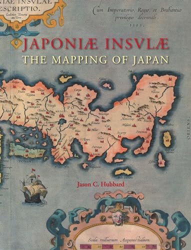
Japoniae Insulae (Japonić Insvlć). The Mapping of Japan: A Historical Introduction and Cartobibliography of European Printed Maps of Japan to 1800
Publicado por HES & De Graaf Publishers B.V. 2012, 2012
ISBN 10: 9061945313ISBN 13: 9789061945314
Librería: Antiquariaat Schot, Hendrik-Ido-Ambacht, Holanda
Valoración del vendedor:

Libro
444 p. Bound in the publisher's blue cloth binding with pictorial dustjacket (Very fine copy, still shrink-wrapped.).
-
Japonić insulć: The Mapping of Japan (Utrecht Studies in the History of Cartography / Utrechtse Hi)
Publicado por Brill | Hes & De Graaf, 2012
ISBN 10: 9061945313ISBN 13: 9789061945314
Librería: GF Books, Inc., Hawthorne, CA, Estados Unidos de America
Valoración del vendedor:
Libro
Condición: Fine. Book is in Used-LikeNew condition. Pages and cover are clean and intact. Used items may not include supplementary materials such as CDs or access codes. May show signs of minor shelf wear.
-

Japoniae insulae. The mapping of Japan. A historical introduction and cartobibiliography of European Printed Maps of Japan before 1800.
Publicado por Hes & De Graaf,, Houten,, 2012
Librería: Daniel Crouch Rare Books Ltd, London, Reino Unido
Miembro de asociación: ABA ILAB PBFA
Valoración del vendedor:

Libro
Hubbard's cartobibliography of Japan Hardcover with full colour dust jacket, with 374 full colour illustrations, 444 pp. The Mapping of Japan systematically categorizes and provides an overview of all the European printed maps of Japan published to 1800. The author has undertaken a review of the literature, conducted an exhaustive investigation in major libraries and private collections, analyzed these findings and then compiled information on 125 maps of Japan. The introduction contains information about the mapping to 1800, the typology of Japan by western cartographers, an overview on geographical names on early modern western maps of Japan and a presentation of the major cartographic models developed for this book.
-

Japoniae insulae. The mapping of Japan. A historical introduction and cartobibiliography of European Printed Maps of Japan before 1800.
Publicado por Hes & De Graaf,, Houten,, 2012
Librería: Daniel Crouch Rare Books Ltd, London, Reino Unido
Miembro de asociación: ABA ILAB PBFA
Valoración del vendedor:
Libro
Hubbard's cartobibliography of Japan Hardcover with full colour dust jacket, with 374 full colour illustrations, 444 pp. The Mapping of Japan systematically categorizes and provides an overview of all the European printed maps of Japan published to 1800. The author has undertaken a review of the literature, conducted an exhaustive investigation in major libraries and private collections, analyzed these findings and then compiled information on 125 maps of Japan. The introduction contains information about the mapping to 1800, the typology of Japan by western cartographers, an overview on geographical names on early modern western maps of Japan and a presentation of the major cartographic models developed for this book.
-
Japoniae Insulae, the Mapping of Japan: A Historical Introduction and Cartobibliography of European Printed Maps of Japan Before 1800
Publicado por Brill Hes & De Graaf, 2012
ISBN 10: 9061945313ISBN 13: 9789061945314
Libro Original o primera edición
Hardcover. Condición: New. First Edition. First Edition thus, as good as new. Japoniae Insulae, the Mapping of Japan: A Historical Introduction and Cartobibliography of European Printed Maps of Japan Before 1800 by Jason C. Hubbard. Published by Brill Hes & De Graaf in 2012. Hardcover ISBN:9789061945314. Collectible item in excellent condition.
-
Japonić insulć: The Mapping of Japan (Utrecht Studies in the History of Cartography / Utrechtse Hi)
Publicado por Brill | Hes & De Graaf, 2012
ISBN 10: 9061945313ISBN 13: 9789061945314
Librería: Tmecca Inc., Seoul, Republica de Corea
Miembro de asociación: ILAB
Valoración del vendedor:
Libro Original o primera edición
Hardcover. Condición: New. Estado de la sobrecubierta: New. 1st Edition. This is Brand New, Still wrapping with Clear Plastic from Publisher. Never Opened.
-

Japonić insulć : the mapping of Japan : historical introduction and cartobibliography of European printed maps of Japan to 1800
Publicado por Houten, Netherlands : H & DG, HES & De Graaf Publishers, 2012
ISBN 10: 9061945313ISBN 13: 9789061945314
Libro Original o primera edición
First Edition. Fine cloth copy in a near-fine, very slightly edge-dulled dust-wrapper=. Remains particularly well-preserved overall; tight, bright, clean and strong. Physical description: 444 pages : illustrations (some colour), maps (some colour) ; 33 cm. Subjects: Early maps Japan. Cartography Japan History. Genre: Cartography. Language: English. 1 Kg.
-

Japoniae Insulae - The Mapping of Japan; Historical Introduction and Cartobibliography of European Printed Maps of Japan to 1800
Publicado por Hes & De Graaf, Houten, Netherlands, 2012
Librería: Argosy Book Store, ABAA, ILAB, New York, NY, Estados Unidos de America
Miembro de asociación: ABAA ILAB
Valoración del vendedor:
Hardcover book in original publishers wrap. Book measures 12 5/8" x 9 3/4". 440 pgs.
-
Japonić insulć : the mapping of Japan : historical introduction and cartobibliography of European printed maps of Japan to 1800
Publicado por Houten, Netherlands : H & DG, HES & De Graaf Publishers, 2012
ISBN 10: 9061945313ISBN 13: 9789061945314
Librería: MW Books, New York, NY, Estados Unidos de America
Valoración del vendedor:
Libro Original o primera edición
First Edition. Fine cloth copy in a near-fine, very slightly edge-dulled dust-wrapper=. Remains particularly well-preserved overall; tight, bright, clean and strong. Physical description: 444 pages : illustrations (some colour), maps (some colour) ; 33 cm. Subjects: Early maps Japan. Cartography Japan History. Genre: Cartography. Language: English. 1 Kg.
-
Japoniae Insulae: The Mapping of Japan: Historical Introduction and Cartobibliography of European Printed Maps of Japan to 1800
Publicado por Hes & De Graff, Houten, 2012
Librería: Yushodo Co., Ltd., Fuefuki-shi, Yamanashi Pref., Japon
Miembro de asociación: ILAB
Valoración del vendedor:
Hardcover. Condición: Fine. Estado de la sobrecubierta: Fine. none. 444p., Studies on the History of Cartography, 14.
-
Japoniae Insulae: The Mapping of Japan: Historical Introduction and Cartobibliography of European Printed Maps of Japan to 1800
Publicado por Hes & De Graff Pub B V, 2012
ISBN 10: 9061945313ISBN 13: 9789061945314
Libro
Hardcover. Condición: Brand New. bilingual edition. 444 pages. Japanese language. 12.50x9.75x1.25 inches. In Stock.
-
Japoniae Insulae Descriptio.
Publicado por [Antwerp: J. B. Vrients, 1608], 1608
Librería: Arader Galleries - AraderNYC, New York, NY, Estados Unidos de America
Valoración del vendedor:
Double-page engraved map (16 3/4 x 22 3/4 in.; 42.6 x 57.8 cm) with fine contemporary handcoloring, Italian text on verso; general age-toning. The first printed map of Japan in an atlas. It was drawn by the Portuguese Jesuit Luis Teixeira and depicts Korea as an island. First published in 1595, this copy is from Vrients' 1608 Italian edition of the Theatrum orbis terrarum. REFERENCE: Van den Broecke 165.1 1608I119 PROVENANCE: "Isseido" (shop stamp on verso).
