Importe total (1 artículo artículos):
Destino del pedido:

JOSE DE VARGAS Y PONCE (21 resultados)
Ir a los resultados principales
Tipo de artículo
- Todo tipo de artículos
- Libros (21)
- Revistas y publicaciones
- Cómics
- Partituras
- Arte, grabados y pósters
- Fotografías
- Mapas
-
Manuscritos y
coleccionismo de papel
Condición
Encuadernación
Más atributos
- Primera edición (6)
- Firmado
- Sobrecubierta (1)
- Con imágenes del vendedor (11)
- Sin impresión bajo demanda (20)
Gastos de envío gratis
Ubicación del vendedor
Valoración de los vendedores
-
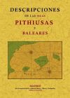
Descripciones de las islas Pithiusas y Baleares
Publicado por Editorial Maxtor Librería, 2008
ISBN 10: 8497614844ISBN 13: 9788497614849
Libro
Condición: New. Idioma/Language: Espańol. Obra de claro interés geográfico y artístico, de eminente carácter localista donde se aborda un estudio muy preciso de las Islas Pitiusas, es decir, las Baleares de hoy en día, con especial atención a las islas de Mallorca y Menorca. *** Nota: Los envíos a Espańa peninsular, Baleares y Canarias se realizan a través de mensajería urgente. No aceptamos pedidos con destino a Ceuta y Melilla.
-
Relacion Del ltimo Viage Al Estrecho De Magallanes De La Fragata De SM Santa Mara De La Cabeza En Los Aos De 1785 Y 1786 1
Publicado por Hardpress Publishing, 2019
ISBN 10: 0371261775ISBN 13: 9780371261774
Librería: PBShop.store US, Wood Dale, IL, Estados Unidos de America
Valoración del vendedor:

Libro
PAP. Condición: New. New Book. Shipped from UK. Established seller since 2000.
Más opciones de compra de otros vendedores en IberLibro
Nuevo desde EUR 26,57
-
![Imagen del vendedor de Relacion del último viage al estrecho de Magallanes de la fragata de s.m. Santa María de la . [LeatherBound] a la venta por True World of Books](https://pictures.abebooks.com/inventory/md/md31533720158.jpg)
Relacion del último viage al estrecho de Magallanes de la fragata de s.m. Santa María de la . [LeatherBound]
Ańo de publicación: 2023
Libro Impresión bajo demanda
LeatherBound. Condición: New. LeatherBound edition. Condition: New. Reprinted from 1788 edition. Leather Binding on Spine and Corners with Golden leaf printing on spine. Bound in genuine leather with Satin ribbon page markers and Spine with raised gilt bands. A perfect gift for your loved ones. NO changes have been made to the original text. This is NOT a retyped or an ocr'd reprint. Illustrations, Index, if any, are included in black and white. Each page is checked manually before printing. As this print on demand book is reprinted from a very old book, there could be some missing or flawed pages, but we always try to make the book as complete as possible. Fold-outs, if any, are not part of the book. If the original book was published in multiple volumes then this reprint is of only one volume, not the whole set. Sewing binding for longer life, where the book block is actually sewn (smythe sewn/section sewn) with thread before binding which results in a more durable type of binding. Pages: 390 Language: Spanish.
-

A Voyage of Discover to the Strait of Megellan
Publicado por Milford House, Boston, 1973
Librería: Karol Krysik Books ABAC/ILAB, IOBA, PBFA, Toronto, ON, Canada
Miembro de asociación: ABAC ILAB IOBA PBFA
Valoración del vendedor:
Cloth. Condición: Fine. No Jacket. Facsimile Edition. 8vo. From the edition of 1820. Bound in brown cloth with gilt title to spine, folding map loosely inserted.
-
Soft cover. Condición: Very Good. Viajeros Y Filosofas 1983 paperback 158 pages folding maps text in Spanish, covers and inside in VERY GOOD CLEAN TIGHT READING ORDER. Full refund if not satisfied. 24 hour despatch.
-
OBRAS ESCOGIDAS
Publicado por FUNDACION JOSE MANUEL LARA, 2012
ISBN 10: 8496824918ISBN 13: 9788496824911
Librería: Librerias Prometeo y Proteo, Malaga, Espańa
Valoración del vendedor:

Libro
Otros. Condición: New. Estado de la sobrecubierta: Nuevo. 01. Llamado el Jovellanos andaluz, Vargas Ponce es uno de los autores más representativos de la literatura neoclásica espańola y uno de los grandes referentes de la Ilustración en la península. Esta amplia selección ofrece muestras de todas las etapas de su. LIBRO.
-
Varones ilustres de la Marina Espańola. Vida de Don Pedro Nińo,primer Conde de Buelna.
Publicado por Imprenta Real,, Madrid,, 1807
Librería: Llibreria Antiquŕria Els Gnoms, Sedó, Espańa
Valoración del vendedor:

292pp. Arbol genealógico.
-
Tauromaquia de Francisco de Goya. Edición facsímil limitada y numerada a partir de las 40 estampas que componen la obra original. + Libro de estudios. + Tauromaquia o arte de torear a caballo y a pie + Buril.
Publicado por Planeta. Calcografía Nacional. Real Academia de Bellas Artes de San Fernando., Barcelona., 2006
Librería: La Nave, Librería Anticuaria., Salamanca, Espańa
Valoración del vendedor:
Condición: BUEN ESTADO. Carpeta contenedora de las láminas en holandesa piel. Estudios encuadernado en seda negra. Y el Arte de torear en holandesa piel con cortes tintados. Estuche contenedor de la obra en seda negra. Edición numerada ante notario de 998 ejemplares, el nuestro nş 252. Libro.
-
Descripciones de las islas Pithiusas y Baleares.Madrid, en la imprenta de la viuda de Ibarra, Hijos y Compania, 1787.
Publicado por Madrid, en la imprenta de la viuda de Ibarra, Hijos y Compania, Madrid, 1787
Librería: Studio Bibliografico Apuleio, Trento, Italia
Miembro de asociación: ALAI ILAB
Valoración del vendedor:
Condición: Buono (Good). 0. Cm. 24, pp. (2) xxiv (2), 158. Con 3 grandi tabelle ripiegate f.t. Bella legatura strettamente coeva in piena pelle con titoli su tassello rosso, fregi e filetti in oro al dorso. Piatti inquadrati da elegante cornice dorata. Sguardie in bella carta policroma d'epoca. Trascurabile macchietta al margine esterno, qualche sporadica fioritura, lievi aloni al margine della carte finali. Esemplare nel complesso fresco e ben conservato, stampato su carta pregiata. JosĂ© Vargas y Ponce (1760-1821), scrittore, storico e ufficiale della Marina spagnola, partecipò alla guerra contro la Prima Repubblica francese. Nel 1786 entrò nella Real Academia de la Historia e in questo contesto scrisse le linee guida per il Dizionario geografico di Spagna e lavorò a un Dizionario nautico che non vide mai la luce. Sempre in quegli anni l'Autore nativo di Cadice ebbe modo di lavorare a quest'importante saggio sulle isole Baleari, una dettagliata descrizione geografica, demografica, economica e storica di Maiorca, Minorca, Ibiza e Formentera. Rara prima edizione sconosciuta alle principali bibliografie. Cfr. Iccu; non in Brunet e Graesse. . . . . . . 0. . Book.
-
Relación Del Último Viage Al Estrecho De Magdallanes De La Fragata De S. M. Santa María De La Cabeza En Los Ańos De 1785 Y 1786. [WITH:] .Apendice A La Relación Del Viage Al Magallanes De La Fragata De Guerra Santa María De La Cabeza, Que Contiene
Publicado por Por la Viuda de Ibarra, Hijos y Companía, Madrid, 1783
Librería: The Book Collector, Inc. ABAA, ILAB, Fort Worth, TX, Estados Unidos de America
Miembro de asociación: ABAA ILAB IOBA
Valoración del vendedor:
Libro Original o primera edición
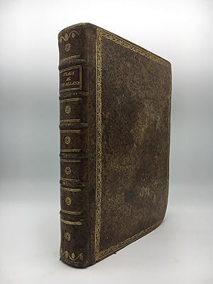
Hardcover. Condición: Very Good. 1st Edition. 2 volumes. [3]+xvi-359 pages with engraved frontispiece portrait of Magellan by Ferdinand, 4 folding tables and 3 folding maps. Appendice: [ii]+97 pages with one folding table and one folding map Lacks the map Carta reducida del estrecho de Magallanes, fragata de S.M. Santa María de la Cabeza. Royal octavo (9 3/4" x 7 1/2") bound in full leather red and black labels to spine in gilt lettering. (Palau 352514 & 352515; Sabin 16765) First edition. The official Spanish documentation of the scientific voyage of the frigate St. Maria de la Cabeza to the Straits of Magellan, the gateway to the Pacific. The expedition served the purpose of gathering scientific and hydrographic information and typified the efforts Spain was making to stimulate research and exploration in her colonies. The second half of the relacion chronicles the historic voyages through the straits, from Magellan and Drake to Bougainville. The maps are fine examples of rare 18th-century Spanish cartography. Two of the charts are detailed delineations of the South American tip and the Tierra del Fuego region, while the other two depict ports along the Straits of Magellan. The appendix includes a description of the Peruvian people. After these expeditions, the Spanish trade routes were exclusively to east coast ports and then overland to Pacific ports. José de Vargas Ponce was a midshipman and later appointed Second Lieutenant and was a member of the Real Academia de la Historia where he worked with Banza and the mathematician Vicente Tofino where he contributed in the publishing the Martime Atlas of Spain. In 1787 he published his description of the Pithiusas and Balearic Islands. Condition: Lacks one map. Appendix rubbed and scuffed. Corners bumped else a very nice set.
-
Relacion del último Viage al Estrecho de Magallanes de la Fragata de S.M. Santa Maria de la Cabeza en los an(n)os de 1785 y 1786. Extracto de todos los anteriores desde su descubrimiento impresos y MSS. Y Noticia de los Habitantes, Suelo, Clima y Prod.
Librería: Lynge & Sřn ILAB-ABF, Copenhagen, Dinamarca
Miembro de asociación: ILAB
Valoración del vendedor:
Original o primera edición
Madrid, 1788-93. 4to. Bound in 2 nice contemp. full sprinkled calf. Gilt borders on covers, 5 raised bands, gilt spine, titlelabels with gilt lettering. The Appendice slightly different bound, but matching. Fine marbled endpapers. Engraved portrait. (6),XVI,359 pp. and 4 folded tables, 4 large folded engraved maps. Appendix: (4),128 pp., 1 folded table and 1 folded engraved map. Clean and fine printed on thick paper. A small wormtract in top of the last 2 maps and the last few leaves (margins). First edition of two important expeditions by Antonio de Córdoba. The first voyage was made with the intention of surveying the Straits of Magellan to see if it was advisable for the Spaniards to continue to use it as a route to the Pacific. It also includes a history of the discovery of the strait, as well as of the expeditions of Cabot, Drake, Bougainville, Carmargo and others. The second voyage includes an interesting account by Cevallos of the first encounter with the natives.Sabin, 16765.
-

RELACION DEL ULTIMO VIAGE AL ESTRECHO DE MAGALLANES DE LA FRAGATA DE S.M. SANTA MARÍA DE LA CABEZA EN LOS AŃOS 1785 Y 1786. EXTRACTO DE TODOS LOS ANTERIORES DESDE SU DESCUBRIMIENTO IMPRESOS Y MSS. Y NOTICIA DE LOS HABITANTES, SUELO, CLIMA Y PRODUCCIONES.
Publicado por VIUDA DE IBARRA, HIJOS Y COMPAŃÍA, MADRID, 1788
Librería: LIBRERIA TORMOS, Aldeamayor Golf, VALLA, Espańa
Valoración del vendedor:
ENCUADERNADO EL LOMO EN PIEL DE CABRA, CONTIENE ESTUCHE DECORATIVO DEL MISMO COLOR QUE LAS TAPAS. RETRATO DE FERNANDO DE MAGALLANES EN FRONTISPICIO + XVI + 359 PÁGINAS + 4 TABLAS DESPLEGABLES, 4 MAPAS DESPLEGABLES. NO CONTIENE APÉNDICE. ESTE LIBRO TRATA SOBRE EL VIAJE DE EXPLORACIÓN MÁS IMPORTANTE DEL SIGLO XVIII AL ESTRECHO DE MAGALLANES. CONTIENE MAPAS MUY DETALLADOS DE LA PATAGONIA, TIERRA DEL FUEGO, LAS ISLAS MALVINAS Y EL ESTRECHO. ATRIBUÍDO A JOSÉ VARGAS PONCE (1760-1821), EL TRABAJO ES EN GRAN PARTE COMPILADO POR DOS LUGARTENIENTES DEL VIAJE, DIONISIO ALCALÁ GALIANO (1760-1805) Y ALESSANDRO BELMONTI. LOS PRINCIPALES OBJETIVOS DE LA EXPEDICIÓN, BAJO EL MANDO DEL CAPITÁN ANTONIO DE CÓRDOBA (MUERTO EN 1811), FUE DETERMINAR SI EL ESTRECHO ERA UNA RUTA COMERCIAL VIABLE PARA ASIA Y EL PACÍFICO, EL MAPA DE LAS COSTAS PATAGÓNICAS, Y RECOMENDAR LOS SITIOS DE ASENTAMIENTO ESPAŃOL. LOS OFICIALES Y LA TRIPULACIÓN DE LA FRAGATA DE GUERRA SANTA MARÍA DE LA CABEZA, ESTUDIANDO LA REGIÓN, LA POBLACIÓN NATIVA, LAS CONDICIONES DEL SUELO, EL CLIMA, LA FLORA, Y LA FAUNA; HICIERON MAPAS DE LA ZONA, Y SE OBSERVA MÁS CUIDADOSA EN LOS PUERTOS, LAS CORRIENTES, ASÍ COMO OTROS DATOS NECESARIOS PARA MARINEROS QUE ATRAVIESEN LA EXTENSIÓN DEL TRAICIONERO ESTRECHO. AL FINAL, SIN EMBARGO LLEGARON A LA CONCLUSIÓN DE QUE EL ESTRECHO ERA DEMASIADO PELIGROSO, LO QUE HACE EL TRANSPORTE TERRESTRE PREFERIBLE ENTRE ATLÁNTICO Y PACÍFICO. LOS INFORMES DEL VIAJE, SON LA INFORMACIÓN MÁS PRECISA DE LA ZONA SUR DE ARGENTINA Y CHILE ENTONCES DISPONIBLE. EL LIBRO DESMIENTE QUE LOS PATAGONES SEAN GIGANTES, COMO ANTIGUAMENTE SE PENSABA POR ÚLTIMO ESTE LIBRO CONTIENE NUMEROSOS CAPÍTULOS DE ANTERIORES VIAJES A TRAVÉS DEL ESTRECHO POR OTROS NAVEGANTES. EL PAPEL DEL LIBRO ES DE UNA EXTRAORDINARIA CALIDAD, ESTE LIBRO HA SIDO ADEMÁS RESTAURADO Y TRATADO PARA EVITAR SU DETERIORO, ES POR ELLO, QUE SE TRATA DE UN EXCELENTE EJEMPLAR, PERFECTAMENTE CONSERVADO. Size: 25 X 20.
-
RELACION DEL ÚLTIMO VIAGE AL ESTRECHO DE MAGALLANES DE LA FRAGATA DE S. M. SANTA MARÍA DE LA CABEZA EN LOS AŃOS DE 1785 Y 1786. Extracto de todos los anteriores desde su descubrimiento impresos y MSS. y noticia de los habitantes, suelo, clima y producciones del estrecho.
Publicado por Imp. Viuda de Ibarra. Madrid, 1788, 1788
Librería: Libreria Anticuaria Farré, Barcelona, BARCE, Espańa
Miembro de asociación: AILA ILAB
Valoración del vendedor:
. 23,5 cm. 3 h., XVI-359 pág. 1 lámina de grabado con retrato de Magallanes, firmado por Fernando Selma en 1788, 4 láminas plegadas de grabados con mapas del estrecho de Magallanes y sus puertos y del sur de la América meridional, 4 láminas plegadas -paginadas 71-74- con tablas de navegación. [Sigue:] APÉNDICE A LA RELACION DEL VIAGE AL MAGALLANES DE LA FRAGATA DE GUERRA SANTA MARÍA DE LA CABEZA, que contiene el de los paquebotes Santa Casilda y Santa Eulalia para completar el reconocimiento del estrecho en los ańos de 1788 y 1789. Imp. de la viuda de Joaquín Ibarra. Madrid, 1793. 2 h., 128 pág. 1 lámina plegada con mapa del estrecho de Magallanes, 1 lámina plegada -paginada 98- con tabla de navegación. Enc. en media piel, puntas algo rozadas. * José de Vargas y Ponce (Cádiz, 1760 - Madrid, 1821) es el encargado de recoger y ordenar los materiales que le facilitaron Dionisio Alcalá Galiano y Alessandro Belmonti, miembros de la expedición, y lo enriqueció con los datos aportados anteriormente por Sarmiento de Gamboa, Drake, Spilberg, Narborough, Carteret, Bougainville. La expedición fue promovida por la Corona espańola con la intención de determinar la viabilidad de la ruta por el Pacífico, por un lado, y por el otro considerar las condiciones para asentar nuevas colonias espańolas. Así pues, comprende numerosas noticias interesantes sobre el clima, geografía, naturaleza y sociedad en Patagonia, Tierra de Fuego, Chile. Los mapas se deben al piloto Joaquín Camacho. Palau 352514-5.
-
Relacion del ultimo viage al estrecho de Magallanes de la fragata de S. M. Santa María de la Cabeza en los ańos de 1785 y 1786.
Publicado por Madrid: Por la viuda de Ibarra, hijos y compańía, MDCCLXXXVIII. [1788]., 1788
Librería: Arader Galleries - AraderNYC, New York, NY, Estados Unidos de America
Valoración del vendedor:
Original o primera edición
Half-Leather. Condición: Very Good. 1st Edition. Remainder of title: Extracto de todos los anteriores desde su descubrimiento impresos y mss. y noticia de los habitants, suelo, clima y producciones del estrecho. 2 volumes, 4to (25 x 18.5 cm.): vol. I: engraved frontispiece (portrait of Magellan by Fernando Selma), [6], xvi, 359 pages, 4 folded engraved maps, and 4 folded letterpress tables (i.e. pp. 71-74); vol. II (Apéndice de la Relacion): [4], 128 pages, 1 folded engraved map, and 1 foldied letterpress table (i.e. p. 98). Bound in varying but complementary contemporary calf-backed marbled paper boards, printed paper spine label on volume one, and red morocco lettering-piece on the spine of the appendix volume (a bit worn at the extremities with minor loss). FIRST EDITION OF THE FIRST COMPREHENSIVE SURVEY OF THE STRAITS OF MAGELLAN AND PATAGONIA. The work was largely compiled from the journals of D.A. Galiano and A. Belmote, Antonio de Cordova's lieutenants, on the his two important expeditions sponsored by the Spanish government in order to determine the feasibility of continuing to use the Straits of Magellan as a route to the Pacific. In addition, the work contains a comprehensive history of the discovery of the strait and includes accounts of the expeditions of Cabot, Drake, Bougainville, Carmargo etc.; the appendix includes a description of the Peruvian people. "After these expeditions, the Spanish trade routes were exclusively to east coast ports and then overland to Pacific ports" (Hill 1756). The five important maps include: "Carta Esferica de la Parte sur de la America Meridional., 1788"; "Carta reducida del Estrecho de Magallanes, 1788"; "Primer Plano de Varios Puertos del Estrecho de Magallanes, Levantados el ano de 1786," with insets of the ports of Bahia De San Nicolas, Tres Bahias, Bahia De Valcarcel, Puerto De San Miguel y Bahia De Gaston, and Puerto De San Antonio y Bahia Valdes; "Segundo Plano de Varios Puertos del Estrecho de Magallanes Levantados el ano de 1786"; and in the appendix, "Carta Reducida del Estrecho de Magallanes, 1786-1789." REFERENCES: Hill (2004) 1756; Palau 352514 & 352515; Sabin 16765 (not including the appendix). Book.
-
RELACION DEL ÚLTIMO VIAGE AL ESTRECHO DE MAGALLANES DE LA FRAGATA DE S.M. SANTA MARIA DE LA CABEZA EN LOS ANOS DE 1785 Y 1786. EXTRACTO DE TODOS LOS ANTERIORES DESDE SU DESCUBRIMIENTO IMPRESOS Y MSS. Y NOTICIA DE LOS HABITANTES, SUELO, CLIMA, Y PRODUCCIONES DEL ESTRECHO
Publicado por La viuda de Ibarra, hijos, y compańia, Madrid, 1788
Librería: William Reese Company - Americana, New Haven, CT, Estados Unidos de America
Miembro de asociación: ABAA ESA ILAB SNEAB
Valoración del vendedor:
[6],xvi,359pp. including four folding tables and four large folding maps. Frontispiece portrait of Magellan by Ferdinand Selma. [bound with:] APENDICE A LA RELACION DEL VIAGE AL MAGALLANES. Madrid. 1793. [4],128pp. including folding table and folding map. Quarto. 19th-century half calf and patterned cloth, spine gilt, original gilt leather label on front board. Moderate edge wear, corners worn. Modern bookplate and small bookseller ticket on front pastedown. Titlepage a bit dusty, else internally clean. Very good. The objective of the voyages recorded here was to determine whether Spanish ships should continue to use the Straits of Magellan in voyages to the Pacific. Under the command of Captain Antonio de Córdoba y Laso, both expeditions ascertained negative conclusions, and afterwards "the Spanish trade routes were exclusively to east coast ports and then overland to Pacific ports" (Hill). A major portion of this work, the first comprehensive study of the Straits of Magellan and Patagonia, was compiled from the journals of D.A. Galiano and A. Belmote, Cordoba's lieutenants. The RELACION. also includes Vargas y Ponce's review of earlier explorations of the area, with descriptions of the region's climate, natural resources, and native peoples. Also includes information on the expeditions of Cabot, Drake, Bougainville, Carmargo, and others. HILL 1756. SABIN 16765, 1729. PALAU 352514, 352515.
-
![Imagen del vendedor de Relación Del Último Viage Al Estrecho De Magdallanes De La Fragata De S. M. Santa María De La Cabeza En Los Ańos De 1785 Y 1786. [WITH:] .Apendice A La Relación Del Viage Al Magallanes De La Fragata De Guerra Santa María De La Cabeza, Que Contiene El De Los Paquebotes Santa Casilda Y Santa Eulalia Para Completar El Reconocimiento Del Estrecho En Los Ańos De 1788 Y 1789. a la venta por D & E LAKE LTD. (ABAC/ILAB)](https://pictures.abebooks.com/inventory/md/md1427758893.jpg)
Relación Del Último Viage Al Estrecho De Magdallanes De La Fragata De S. M. Santa María De La Cabeza En Los Ańos De 1785 Y 1786. [WITH:] .Apendice A La Relación Del Viage Al Magallanes De La Fragata De Guerra Santa María De La Cabeza, Que Contiene El De Los Paquebotes Santa Casilda Y Santa Eulalia Para Completar El Reconocimiento Del Estrecho En Los Ańos De 1788 Y 1789.
Publicado por Madrid: Por la Viuda de Ibarra, Hijos y Companía, 1788-93., 1788
Librería: D & E LAKE LTD. (ABAC/ILAB), Toronto, ON, Canada
Miembro de asociación: ABAC ILAB
Valoración del vendedor:
Original o primera edición
Hardcover. Condición: Very Good. 1st Edition. 2 Volumes in 1. 4to. pp. 3 p.l., xvi, 70, 75-359; 2 p.l., 128. 4 folding tables numbered 71-74 inserted between pp. 70 and 75 in Vol. I. 1 folding table in Vol II. engraved portrait of Magellan by Ferdinand Selma. 5 large folding engraved maps, 2 with 12 plans of ports, another with 3 inset plans. 19th century quarter roan (spine incorrectly lettered, occasional light spotting, last map stained, few short insignificant tears in maps). First Edition, complete with the Rare Supplement. An account of Don Antonio de Córdoba s scientific and hydrographic survey of the Strait of Magellan, 1785-86, 1788-89, compiled by José de Vargas Y Ponce, Spanish geographer and naval officer, mainly from the journals of Córdoba s lieutenants, Dionisio Alcalá Galiano and Alejandro Belmonte. The expedition was appointed by the Spanish Crown to determine the exact navigability of the strait and the advisability of the Spaniards continuing to use the passage in voyages to the Pacific, as well as to investigate the plant and animal life of the region, with a view toward colonization. The findings were negative and the Spaniards subsequently exclusively favoured overland trade routes from east coast ports of South America to the Pacific ports. Included in the first volume are extensive notes on the natural history and climate of the region, an account of the customs of the Patagonian Indians, and a resumé of discovery and exploration from the time of the discovery of the strait by Magellan through the voyages of Sarmiento de Gamboa, Drake, Spilberg, Narborough, Carteret, Bougainville, &c. Bell V25 (without the supplement). Hill p. 305. Howgego C180. JCB II 3224. Sabin 16765 (without the supplement & incorrectly attributing the work to Córdoba).
-
Relación del último viage al Estrecho de Magallanes de la fragata de S.M. Santa María de la Cabeza en los ańos de 1785 y 1786. [and] Apéndice a la Relacion.
Publicado por Ibarra, Madrid, 1793
Librería: Hordern House Rare Books, Surry Hills, NSW, Australia
Miembro de asociación: ANZAAB ILAB
Valoración del vendedor:
Original o primera edición
Condición: A very good copy. Quarto, two volumes bound together, with an engraved portrait of Magellan as frontispiece, five fine large folding maps and five folding tables; contemporary calf-backed marbled boards.f. The full first edition, complete with the separately published Apendice a la Relación (Madrid, 1793) which appeared ten years after the main work and is not present in all copies. This is the best early description of Patagonia and the Straits of Magellan, giving the official account of the two expeditions made by Antonio de Córdoba to 'ascertain the advisability of Spaniards continuing to use the Strait in voyages - the results indicated the negative. After these expeditions the Spanish trade routes were exclusively to east coast ports and then overland to the Pacific ports.' (Hill). As part of this, the Relación provides a general history of earlier voyages of discovery to the Strait. The large folding maps, fine and detailed, are all based on observations made during the Córdoba voyages. Córdoba's exploration of the Strait of Magellan --recognised then as now an area of strategic and navigational significance -- is accompanied by Vargas y Ponce's summary of the early explorations of the area, mainly from an examination of original manuscripts in the Spanish archives. He discusses various means of navigating the Strait, with detailed sailing instructions, and describes the climate, indigenous peoples and natural history of the region. .
-
Relacion del Ultimo Viage al Estrecho de Magallanes de la Fragata de S.M. Santa Maria de La Cabeza en los Anos de 1785 y 1786: Extracto de Todos los Anteriores desde su descubrimiento impresos y MSS
Publicado por 1788-1793, 1788
Librería: Maggs Bros. Ltd ABA, ILAB, PBFA, BA, London, Reino Unido
Miembro de asociación: ABA ILAB PBFA
Valoración del vendedor:
y Noticia de lost Habitantes, Suelo, Clima y Producciones del Estrecho. Trabajada de Orden del Rey. With - Appendice a la Relacion del Viage al Magallanes de la Fragata de Guerra Santa Maria de la Cabeza, que contiene el de los Paquebotes Santa Casilda y Santa Eulalia para completar el Reconocimiento del Estrecho en los Anos de 1788 y 1789. 2 volumes. 1st editions of this translation. 4to. xvi,359pp. plus 4 fine folding maps (1 with small marginal tear, not affecting map), 4 folding tables and engraved frontispiece portrait - & - (vi),128pp. plus a fine folding map and a folding table. The first volume in full contemporary mottled calf, spine decorated gilt and with gilt borders. Very good. The appendix volume in contemporary quarter calf, with marbled papers boards, fore-corners a little bumped. Ibarra, Madrid.
-
Relación del ultimo viage al Estrecho de Magallanes de la fragata de S. M. Santa Maria de la Cabeza en los anos de 1785 y 1786. Extracto de todos los anteriores desde su descubrimiento impresos y mss. y noticia de los habitantes. 1788. Madrid. Viuda de Ibarra
Publicado por Viuda de Ibarra, Hijos y Compańía, Madrid, 1788
Librería: Donald A. Heald Rare Books (ABAA), New York, NY, Estados Unidos de America
Miembro de asociación: ABAA ILAB
Valoración del vendedor:
Original o primera edición
4to. (9 3/8 x 6 14/16 inches). Engraved portrait frontispiece, 4 folding engraved maps and 4 folding tables, number in ink manuscript to foot of title, epigraph leaf with later ink note and bookplate of Maria Zoila Godoy de Cobo [bound with:] Apéndice a la Relacion del Viage al Magallanes. Madrid: Viuda de Joaquin Ibarra, 1793. First Edition. Folding table and folding map. Contemporary red morocco gilt, with supralibros of Charles III on boards, double-fillet and roll-tooled borders to boards, raised bands to spine with simple tooling, green morocco lettering piece, blue silk endpapers. Provenance: Maria Zoila Godoy de Cobo, Argentinian heiress, philanthropist and patron of the arts, one of the early benefactors of the Museo Nacional de Bellas Artes of Buenos Aires, Argentina; engraved bookplate. First edition, one of the classic works of navigation to the Magellan Strait, here in a fine copy bound in the contemporary red morocco with the arms of Charles III of Spain, bound post mortem, as the appendix was printed in 1793 and Charles III died in 1793; normally only the Relacion is found bound with Charles III s arms, copies with both works bound together as here with the arms are excessively rare. It can be considered a tribute to Charles III, under whose reign the expedition was ordered. The fact that even after the King's death there was a desire to have the book presented with his arms is a testament to the magnitude of the expedition commissioned by the crown, and the respect held for the King, one of the most active in the administration and reform of the Indies. The Relacion is one of the best descriptions of the Strait of Magellan and Patagonia in the 18th century. It is based on the scientific explorations undertaken by Captain Antonio de Cordoba on board the frigate Santa Maria de la Cabeza, with the aim of exploring Patagonia and to determine the continuity of the use of the Strait for Spanish ships in voyages to the Pacific, although without success as "after these expeditions the Spanish trade routes were exclusively to east ports and then overland to the Pacific ports" (Hill). Vargas y Ponce, to whom authorship is normally attributed, used also the journals of Lieutenants Galiano and Belmonte, who sailed with Cordoba. In 1793, an Appendix was published "Obra interesante y bien publicada" (Palau); this later part is a historical view of former expeditions, including those of Drake and Bougainville. The illustration of this work comprises -between the Relacion and the Apendice- five large folding maps (including the "Carta reducida del Estrecho de Magallanes", "Carta Esferica de la parte sur de la América Meridional", and two multi-inset maps of ports), a frontispiece portrait of Fernando de Magallanes by Selma, and five folding tables. Sabin 16765 & 1729; Hill 1756.

![Imagen del vendedor de Relación Del Último Viage Al Estrecho De Magdallanes De La Fragata De S. M. Santa María De La Cabeza En Los Ańos De 1785 Y 1786. [WITH:] .Apendice A La Relación Del Viage Al Magallanes De La Fragata De Guerra Santa María De La Cabeza, Que Contiene a la venta por The Book Collector, Inc. ABAA, ILAB](https://pictures.abebooks.com/inventory/md/md31130195054.jpg)
![Imagen del vendedor de Relación del último viage al Estrecho de Magallanes de la fragata de S.M. Santa María de la Cabeza en los ańos de 1785 y 1786. [and] Apéndice a la Relacion. a la venta por Hordern House Rare Books](https://pictures.abebooks.com/inventory/md/md13245438754.jpg)