Importe total (1 artículo artículos):
Destino del pedido:

JOHN SPEED E G R TAYLOR (16 resultados)
Ir a los resultados principales
Tipo de artículo
- Todo tipo de artículos
- Libros (16)
- Revistas y publicaciones
- Cómics
- Partituras
- Arte, grabados y pósters
- Fotografías
- Mapas
-
Manuscritos y
coleccionismo de papel
Condición
- Todo
- Nuevos
- Antiguos o usados
Encuadernación
- Todo
- Tapa dura (14)
- Tapa blanda
Más atributos
- Primera edición (5)
- Firmado
- Sobrecubierta (9)
- Con imágenes del vendedor (8)
- Sin impresión bajo demanda
Gastos de envío gratis
Ubicación del vendedor
Valoración de los vendedores
-

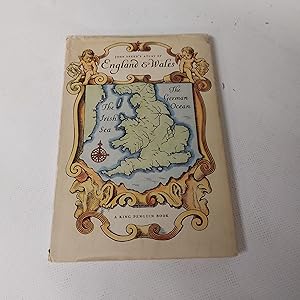
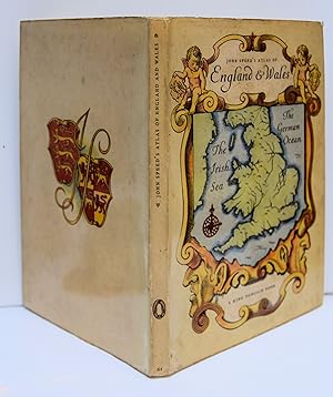
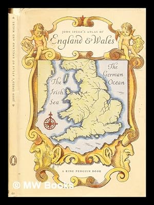
An Atlas of Tudor England and Wales.
Publicado por 1st edit., King Penguin, 1951. Very good copy in d.w. (small tears), 1951
Librería: R.G. Watkins Books and Prints, Ilminster, SOMER, Reino Unido
Valoración del vendedor:

40 colour maps; 32pp; sellotape marks on endpapers. orig. boards,
-
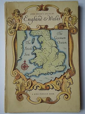
AN ATLAS OF TUDOR ENGLAND AND WALES. (The King Penguin Books 61)
Publicado por Penguin Books, 1951
Librería: GfB, the Colchester Bookshop, Colchester, Reino Unido
Valoración del vendedor:
Hardcover. Condición: Fair. Estado de la sobrecubierta: Fair. Penguin Books, 1951. Hardback, d/j, 8vo, 32pp, 40 plates. Slight stain to endpaper, d/j price-clipped, a little worn and torn. A fair copy. /0.2uk.
-
An Atlas of Tudor England and Wales: Forty Plates from John Speed's Atlas of 1627
Publicado por Penguin Books, 1951
Libro
Hardcover. Condición: Very Good. Estado de la sobrecubierta: Very Good. No internal markings; unclipped D/J is protected with removable premium grade clear wrap.
-
Unknown Binding. Condición: Good. spine cover has splits and missing part of top area reast of book in good condition with tight binding.
-
An Atlas of Tudor England And Wales John Speed's pocket Atlas
Publicado por Penguin, 1951
Librería: Cambridge Rare Books, Cambridge, GLOUC, Reino Unido
Valoración del vendedor:
Hardcover. Condición: GOOD. 1951-01-01. Penguin. Hardcover. ACCEPTABLE DJ Acceptable. Edgewear. 7x5.
-
An atlas of Tudor England and Wales : forty plates from John Speed's pocket atlas of 1627 / described by E.G.R. Taylor
Publicado por London: Penguin Books, 1951
Librería: MW Books, New York, NY, Estados Unidos de America
Valoración del vendedor:
Reprint. Near fine cloth copy in a near-fine, very slightly edge-nicked and dust-dulled dust-wrapper. Remains particularly well-preserved overall; tight, bright, clean and strong. Physical description; 32 pages : illustrations ; 19 cm. Subjects; Early maps ; Facsimiles. Historical geography ; Maps. Wales Maps ; Early works to 1800. Great Britain History Elizabeth, 1558-1603 ; Maps. 1 Kg.
-

An atlas of Tudor England and Wales : forty plates from John Speed's pocket atlas of 1627 / described by E.G.R. Taylor
Publicado por London: Penguin Books, 1951
Reprint. Near fine cloth copy in a near-fine, very slightly edge-nicked and dust-dulled dust-wrapper. Remains particularly well-preserved overall; tight, bright, clean and strong. Physical description; 32 pages : illustrations ; 19 cm. Subjects; Early maps ; Facsimiles. Historical geography ; Maps. Wales Maps ; Early works to 1800. Great Britain History Elizabeth, 1558-1603 ; Maps. 1 Kg.
-
An atlas of Tudor England and Wales (King Penguin)
Publicado por Penguin Books, 1951
Librería: Simply Read Books, Boat Of Garten, Reino Unido
Valoración del vendedor:
Libro Original o primera edición
Hardcover. Condición: Very Good. Estado de la sobrecubierta: Good. 1st Edition. 1951 Penguin Books first edition hardback, King Penguin no 61; pictorial boards; very good, clean and sound copy, Protected by a jacket which has minor marks and rubs, is price-clipped and has a closed edge tear; UK bookdealer, 40 colour plates from 1627, there is also a battered old card of Kent of 1627 laid in to the rear. 32 pages, plus plates.
-
An Atlas of Tudor England and Wales - Forty Plates from John Speed's Pocket Atlas of 1627
Publicado por King Penguin , 1951,, 1951
hardback, small 8vo, 40 plates, owner's inscription on endpaper, otherwise clean and tight, no inscriptions, pictorial boards, Very Good / Good dustwrapper, wrapper edges rubbedand slightly frayed, , not price-clipped.
-
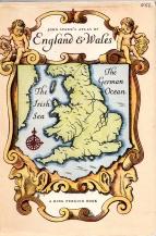
![Imagen del vendedor de An Atlas of Tudor England and Wales [King Penguin no.61] a la venta por Kerr & Sons Booksellers ABA](https://pictures.abebooks.com/inventory/md/md31597125889.jpg)
An Atlas of Tudor England and Wales [King Penguin no.61]
Publicado por Penguin Books, London, 1951
Librería: Kerr & Sons Booksellers ABA, Cartmel, CMA, Reino Unido
Miembro de asociación: ABA ILAB
Valoración del vendedor:
Libro Original o primera edición
Hardcover. Condición: Very Good. Estado de la sobrecubierta: Very Good. 1st Edition. 1951, 1st. Octavo. 31pp plus 40 plates. Original printed papered boards, in the matching dust jacket. Price intact. Small nick/crease to tail edge of jacket front. Overall a 'Very Good' copy.
-
AN ATLAS OF TUDOR ENGLAND AND WALES
Publicado por King Penguin, HARMONDSWORTH, 1951
Libro Original o primera edición
Hardback. Condición: Fine. John Speed Ilustrador. First Edition. This copy is in fine, unmarked condition bound in illustrated paper covered boards with black titling to the spine. This copy is bright, tight, white and square. The unclipped dustwrapper is sunned to the spine but still in very good plus condition. International postal rates are calculated on a book weighing 1 Kilo, in cases where the book weighs more than 1 Kilo increased postal rates will be quoted, where the book weighs less then postage will be reduced accordingly. Illustrated with 40 colour plates from John Speed's Pocket Atlas of 1627. 32 pages (text), 40 pages of Plates. Ref KKK 1.
-
AN ATLAS OF TUDOR ENGLAND AND WALES; Forty Plates from John Speed's Pocket Atlas of 1627
Publicado por Penquin,, London,, 1953
Librería: Harry E Bagley Books Ltd, Fredericton, NB, Canada
Valoración del vendedor:

Libro
Hardcover. Condición: Very Good. Estado de la sobrecubierta: Very Good. Originally published: 1951. 31 p., 40 p. of plates : col. maps ; d.j. is NOT price-clipped, Introduced and Described by E.G.R. Taylor, King Penquin No. 61,small ink number on upper edge of front panel of d.j. minor wear at d.j. corners, end papers toned. Size: 12 mo., (19 cm).
-
An Atlas of Tudor England and Wales: 61
Publicado por Penguin Books, London, 1951
Librería: Babushka Books & Framers, Isle of Wight, Reino Unido
Valoración del vendedor:
Original o primera edición
Hardcover. Condición: Very Good. Estado de la sobrecubierta: Very Good. Forty Plates from John Speed's Pocket Atlas of 1627 Ilustrador. 1st Edition.
-
An Atlas of Tudor England and Wales - Forty Plates from John Speed's Pocket Atlas of 1627 - Introduced and Described by E.G.R. Taylor.
Publicado por Penguin Books - London, 1951
Librería: Barberry Lane Booksellers, Bar Harbor, ME, Estados Unidos de America
Valoración del vendedor:
Libro Original o primera edición
Hardcover. Condición: Near Fine. Estado de la sobrecubierta: Very Good. 1st Edition. Printed illustrated boards in Near Fine condition with sharp corners and no markings or flaws inside or out. Matching Dust Jacket has had some archival tape repair but shows very minimal scuffing or shelfwear - bright colors, sharp edges. Very Good+ and unclipped with original price sticker of .95 cents. This is No. 61 in the King Penguin series - beautifully produced with 40 full color plates - exact reproductions of the original maps produced by Speed in the original pocket atlas of 1627.
-
AN ATLAS OF TUDOR ENGLAND AND WALES Forty Plates from John Speed's Pocket Atlas of 1627 introduced and described by E. G. R. Taylor. (King Penguin. 61).
Publicado por Penguin Books., London, 1951
Librería: Marrins Bookshop, Folkestone, KENT, Reino Unido
Miembro de asociación: ABA ILAB PBFA
Valoración del vendedor:
Small 8vo. 7.5 x 5 inches. 31 + [1] pp. In pictorial stiff card boards, in matching unclipped dust wrapper which has minor edge wear. Small dent at tail of spine and a little foxing largely confined to edges; otherwise a very good copy. Illustrated by 40 pages of coloured map plates. Decorated by title page vignette. King Penguin edition of the the county maps of England (and one of The Kingdom of England and one of Wales and Monmouthshire). From the 1627 pocket edition of England, Wales, Scotland and Ireland, described and abridged, by the cartographer and historian, John Speed (1552?-1629). Edited by Eva Germaine Rimington Taylor (1879-1966), geographer and historian of science, who was professor of geography at the University of London, 1930-44. KING PENGUIN ATLAS ATLAS 17TH CENTURY ILLUSTRATED KING PENGUIN.
-
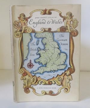
John Speed's Atlas of England & Wales
Publicado por Penguin Books Ltd, London, 1953
Librería: Karol Krysik Books ABAC/ILAB, IOBA, PBFA, Toronto, ON, Canada
Miembro de asociación: ABAC ILAB IOBA PBFA
Valoración del vendedor:
Hardcover. Condición: Very Good. Estado de la sobrecubierta: Good. Speed, John Ilustrador. 2nd Edition. 12mo - over 6ľ - 7ľ" tall. Pictorial paper boards in matching dust jacket. King Penguin # 61. Very good plus condition, color maps, a few tiny tears in jacket, light foxing on reverse of jacket. 40 pp.