Importe total (1 artículo artículos):
Destino del pedido:

GROSS, ALEXANDER F R G S (11 resultados)
Ir a los resultados principales
Tipo de artículo
- Todo tipo de artículos
- Libros (8)
- Revistas y publicaciones
- Cómics
- Partituras
- Arte, grabados y pósters
- Fotografías
- Mapas (3)
-
Manuscritos y
coleccionismo de papel
Condición
- Todo
- Nuevos
- Antiguos o usados
Encuadernación
Más atributos
- Primera edición (3)
- Firmado
- Sobrecubierta
- Con imágenes del vendedor (7)
- Sin impresión bajo demanda
Ubicación del vendedor
Valoración de los vendedores
-

The Perma Handy World Atlas
Publicado por New York: Permabooks / Permabook / Perma # P70 1st Edition, 1950
Original o primera edición
Hard Cover. Condición: Very Good+. No Jacket. First Edition. ----------small hardcover, issued without a dust jacket. In the late 1940s and the early 1950s, Permabooks issued this series of "hardcover paperbacks", which were the same size (and price) as a conventional paperback, but had hard glossy pictorial covers rather than the usual soft paper covers. The name "Permabooks" was quite apt, as they have stood up quite well over the years. The worlld as it was in 1950, facts, colour maps. Modest wear to spine extremities and corners, a VG+ copy.
-
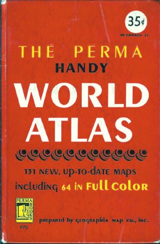
The Perma Handy World Atlas
Publicado por New York: Permabooks / Permabook / Perma # P70 1st Edition, 1950
ISBN 10: 3794501810ISBN 13: 9783794501816
Librería: West Coast Bookseller, Moorpark, CA, Estados Unidos de America
Valoración del vendedor:

Libro
Hardcover. Book has wear from age. Pages ha.
-
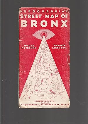
Geographia STREET MAP OF BRONX house numbers transit lines etc.
Publicado por Geographia Map Co., Inc., [Undated, between 1943 and 1963, probably 1940s], 145 West 57th Street, New York 19, New York, 1963
Librería: Meir Turner, New York, NY, Estados Unidos de America
Valoración del vendedor:

Mapa
Soft cover. Condición: Good. Folded: 240 x 126 mm. In color. Some tears along the seams, where the paper is folded.
-

The Daily Telegraph WAR MAP of EUROPE (No. 1.)
Publicado por "Geographia," Ltd, London, 1914
Librería: Peter L. Masi - books, MONTAGUE, MA, Estados Unidos de America
Miembro de asociación: SNEAB
Valoración del vendedor:
Pamphlet. Condición: Used - Very Good. London: Geographia, no date, ca 1914. 27 x 39" folding color map, 8 x 5" printed card cover. Cover worn, edges chipped, 2 tiny splits, map VG.
-
New War Map of Oceania and Australia - The Solomons and Other Potential Island Battle Areas in the Pacific
Publicado por Geographia Map Co., New York.
Librería: The Book Bin, Salem, OR, Estados Unidos de America
Miembro de asociación: ABAA CBA ILAB
Valoración del vendedor:
Libro
Paperback. Condición: Fair. No date [c.1942]. Size 41 x 27 inches, Extra Large Scale. Folds to 8 x 9 inches. There are tears along many of the folds, but it is still in one piece, large print, colors bright, fair. > Language: English | > Size: Folio | > Media/Binding: Soft cover |.
-
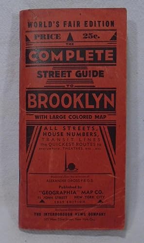
Complete Street Guide to Brooklyn; World's Fair Edition
Publicado por Geographia Map. Co, New York, 1939
Librería: Yesterday's Gallery, ABAA, East Woodstock, CT, Estados Unidos de America
Miembro de asociación: ABAA ILAB
Valoración del vendedor:
1939 Edition. 32 mo. Red printed cover. Street guide includes all streets (listed alphabetically), house numbers, and transit lines, etc. Includes large folding map. Very Good.
-
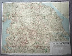
Large Folding Linen Backed MAP of LANCASHIRE & YORKSHIRE by Alexander Gross F.R.G.S.
Publicado por Geographia Ltd. 55 Fleet Street, London, 1111
Librería: Andrew Cox PBFA, Shropshire, Reino Unido
Miembro de asociación: PBFA
Valoración del vendedor:
Mapa Original o primera edición
Hardcover. Condición: Good. Alexander Gross F.R.G.S. Ilustrador. 1st Edition. Undated, possibly circa 1930s, this is a large linen backed folding map of Lancashire and Yorkshire by Alexander Gross, housed in blue cloth covers measuring 10 inches by 7 inches approx., the map opened measures 44 inches by 34 inches approx. some fading to covers, slight wear to some of the panel edges of the map else in good general condition.
-
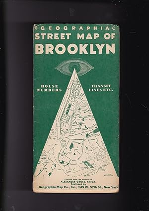
Geographia Street Map of Brooklyn house numbers, transit lines, playgrounds, wading pools, etc.
Publicado por Geographia Map Co., Inc [undated, between 1943 and 1963], 145 West 57 Street, New York 19 New York, 1963
Librería: Meir Turner, New York, NY, Estados Unidos de America
Valoración del vendedor:
Libro
Soft cover. Condición: Very Good. No Jacket. Opened the map is 107 x 72 cm.
-
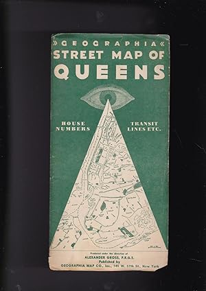
Geographia Street Map of Queens numbers, transit lines, playgrounds, wading pools, etc.
Publicado por Geographia Map Co., Inc [undated, between 1943 and 1963], 145 West 57 Street, New York 19 New York, 1963
Librería: Meir Turner, New York, NY, Estados Unidos de America
Valoración del vendedor:
Libro
Soft cover. Condición: Very Good. No Jacket. Opened the map is 101 x 72 cm.
-
Map Of Northern Counties 25/-
Publicado por Geographia Ltd. STRAND, London, 1922
Mapa Original o primera edición
Hardcover. Condición: Near Fine. 1st Edition. 1st edition? Narrow 4to. 4 x 6 panels on cloth back. Green cloth, rounded ends to covers, embossed in gilt. Small bump top corner of covers, a few small fox marks, but clean and tight. VG+.
-
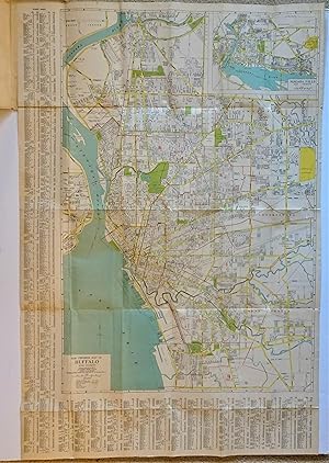
Geographia Map Company's The Premier Street Map of Buffalo (NY) House Numbers - Transit Lines - Postal Zones - Street Index, Etc.
Publicado por Geographia Map Company, Inc., New York
Librería: Dale Steffey Books, ABAA, ILAB, Bloomington, IN, Estados Unidos de America
Miembro de asociación: ABAA ILAB
Valoración del vendedor:
Folded Map. Condición: Very Good. No date, 2 digit zip code dates from 1943-1963, Worldcat lists this map 195? Large folded map in attached protective folder, 9 1/2" x 4 1/2" , map opens to 40 1/4" x 26 3/4". Full color. Printed one side only. Includes index and inset of Niagara Falls and vicinity (10 1/4" x 7 1/8"). Scale [ca. 1:30,000]. Very Good folder, rubbed and with small creases and light edge wear. Map is Near Fine, light toning, no tears, well suited for framing. Size: 9 1/2" x 4 1/2".