Importe total (1 artículo artículos):
Destino del pedido:

CALIFORNIA MAP (59 resultados)
Ir a los resultados principales
Tipo de artículo
- Todo tipo de artículos
- Libros (53)
- Revistas y publicaciones (2)
- Cómics
- Partituras
- Arte, grabados y pósters (1)
- Fotografías
- Mapas (3)
-
Manuscritos y
coleccionismo de papel
Condición
Encuadernación
Más atributos
- Primera edición (19)
- Firmado
- Sobrecubierta (1)
- Con imágenes del vendedor (21)
- Sin impresión bajo demanda (57)
Gastos de envío gratis
Ubicación del vendedor
Valoración de los vendedores
-

The Mother Lode
Publicado por Automobile Club of Southern California, 1988
Librería: Ahab Books, Glencoe, CA, Estados Unidos de America
Valoración del vendedor:

Paperback. Condición: Good Plus. Photographs & Maps Ilustrador. Minor cover wear.
-
The California Geographer, Volume XXVI, 1986
Publicado por California Geographical Society, Chico, Ca, 1986
Librería: Ann Wendell, Bookseller, Oroville, CA, Estados Unidos de America
Valoración del vendedor:
Libro
Soft cover. Condición: Very Good. Photographs & Maps Ilustrador. Very good clean & tight softcover. Size 6x8 with 103 pages.
-
Soundings: Collections of the University Library (Volume II, Number 2
Publicado por University of California Los Angeles, Los Angeles, 1970
Librería: Vashon Island Books, Vashon, WA, Estados Unidos de America
Valoración del vendedor:
Original o primera edición
Paperback. Condición: Very Good. b/w Illustration & Folding Maps Ilustrador. First Edition. Includes: "The papers of Charles M Hathaway" by Christian Brum; "the Nuremburg Chronicle and the koberger quincentenary" by Bogdan Deresiewicz (with illustration). Size: 8vo - over 7ľ" - 9ľ" tall. Book.
-
Soundings: Collections of the University Library (Volume I, Number 1 May, 1969
Publicado por University of California Los Angeles, Los Angeles, 1969
Librería: Vashon Island Books, Vashon, WA, Estados Unidos de America
Valoración del vendedor:
Original o primera edición
Paperback. Condición: Very Good. b/w Illustration & Folding Maps Ilustrador. First Edition. Includes: "the Lotte Lehmann Archive"; "Cliveden and other World War I Collections"; "Confederate Additions to the Wyles Collection"; plus more. Size: 8vo - over 7ľ" - 9ľ" tall. Book.
-
Ventura Basin Tectonic Sheet, Ventura Sheet ( California ).
Publicado por Coast Geological Society, California, Folded Sheet., 1976
Librería: Eryops Books, Stephenville, TX, Estados Unidos de America
Valoración del vendedor:
Mapa
Large folded tectonic/structural map; ex-corporate library; minor shelfwear; o/w in very good condition. Map.
-
Pacific Discovery, July-August 1954, A Journal of Nature & Man in the Pacific World
Publicado por California Academy of Sciences, San Francisco, 1954
Librería: David Gaines, Eureka, CA, Estados Unidos de America
Valoración del vendedor:
Libro Original o primera edición
Soft cover. Condición: Very Good. No Jacket. Various (Maps, Photographs) Ilustrador. First. Wraps (PB) in very good condition with cover wear and slight bend in middle. Special New Zealand issue covering conservation efforts to save its big trees, the kauri, History of Maori fishing, the story of their whaling industry and other supplemental features. 36 pages.
-
Antiquarian Book Review Volume XXXVII Number 9 Issue No 311 February 2002
Publicado por Countrywide Editions Limited, 2002
Revista / Publicación
Soft cover. Condición: Very Good. 60 pages. "Saving Face" (16th century plastic surgery) by Christine Thompson / "The Reel Story" (Hollywood's vision of book dealers) by Anthony Lane / "Two Gentlemen From Los Angeles" by Carol Grossman / "California Dreaming" (17th century West Coast USA maps) by Richard Lan.
-
GEN. GRANT AND SEQUOIA NATIONAL PARKS,
Publicado por California State Automobile Assn., San Francisco, CA, 1939
Librería: Chloe's Books, Loomis, CA, Estados Unidos de America
Valoración del vendedor:
Condición: Good. Reprint. GEN. GRANT AND SEQUOIA NATIONAL PARKS, to San Joaquin Valley and connections to coast route. Copyright by California State Automobile Assn. San Francisco, CA. No date. A single sheet map, folded, printed in black and red. 18.5 x 13.2 inches Coded: "Form M-32". "6-39". Travel times and park information printed on the back of the sheet. A little fading and tearing at the folds, near very good. A small rubberstamp from the Sacramento office of the Automobile Association.
-
A HANDBOOK ON THE WAR IN ASIA
Publicado por Boalt Hall Action Committee, Berkeley, 1970
Librería: David Gaines, Eureka, CA, Estados Unidos de America
Valoración del vendedor:
Libro Original o primera edición
Soft cover. Condición: Very Good. No Jacket. Various (Maps) Ilustrador. First Printing. Wraps (PB) in very good + condition. Political analysis of the U.S. illegal involvment in the Vietnam war. 15,000 students protested at the university, formed action committees and eventually with massive support from across the country, closed down the American war machine. Includes cut out article on "The Dark Side of L. B. J", from Esquire magazine. Also includes two fact sheets on the Vietnam war. 72 pages.
-

The Mother Lode of California
Publicado por ACSA, Los Angeles, 1960
Librería: Peninsula Books, Traverse City, MI, Estados Unidos de America
Valoración del vendedor:
Softcover. Condición: Very Good+. Illustrated by Maps Ilustrador. Two pages of strip maps showing auto tours of California Gold Rush sites, as well as histories of each community and gold rush sites of note along the way. Yellow printed, stapled wrappers with black cover lettering and decoration of a prospector panning for gold. This is a nice clean, tight and unmarked pamphlet. Looks like it was never used. ; Maps; 16mo 6" - 7" tall; 42 pages.
-
Field Trip to The Geysers, Sonoma County, California. September 28,1968. San Francisco, CA.
Publicado por N.C.G.S. San Francisco, CA. 1968, San Francisco, CA., 1968
Librería: Abracadabra Books 50% Off Sale!, Denver, CO, Estados Unidos de America
Valoración del vendedor:

Map Illustrations Ilustrador. Ex-Lib, ow VG.
-
California Oil Fields Vol. 14. No.4. 1928
Publicado por California State Mining San Francisco 1928, San Francisco, 1928
Librería: Abracadabra Books 50% Off Sale!, Denver, CO, Estados Unidos de America
Valoración del vendedor:
Original o primera edición
folding maps Ilustrador. 1st edition. Very Good tight condition softcover page edges wrinkled.
-
California Oil Fields Vol. 12. No.12. 1927
Publicado por California State Mining San Francisco 1927, San Francisco, 1927
Librería: Abracadabra Books 50% Off Sale!, Denver, CO, Estados Unidos de America
Valoración del vendedor:
Original o primera edición
folding maps Ilustrador. 1st edition. Good tight condition softcover edge in library binding.
-
California Oil Fields Vol. 13. No.12. 1928
Publicado por California State Mining San Francisco 1928, San Francisco, 1928
Librería: Abracadabra Books 50% Off Sale!, Denver, CO, Estados Unidos de America
Valoración del vendedor:
Original o primera edición
folding maps Ilustrador. 1st edition. Good tight condition softcover edge taped.
-
California Oil Fields Vol. 13 No. 4. 1927
Publicado por California State Mining San Francisco 1927, San Francisco, 1927
Librería: Abracadabra Books 50% Off Sale!, Denver, CO, Estados Unidos de America
Valoración del vendedor:
Original o primera edición
folding maps Ilustrador. 1st edition. Good tight condition softcover edge taped.
-
California Oil Fields Vol. 14. No.5. 1928
Publicado por California State Mining San Francisco 1928, San Francisco, 1928
Librería: Abracadabra Books 50% Off Sale!, Denver, CO, Estados Unidos de America
Valoración del vendedor:
Original o primera edición
folding maps Ilustrador. 1st edition. Very Good tight condition softcover.
-
California Oil Fields Vol. 12 No. 10. 1927
Publicado por California State Mining San Francisco 1927, San Francisco, 1927
Librería: Abracadabra Books 50% Off Sale!, Denver, CO, Estados Unidos de America
Valoración del vendedor:
Original o primera edición
folding maps Ilustrador. 1st edition. Good tight condition softcover edge taped.
-
California Oil Fields Vol. 14. No.2. 1928
Publicado por California State Mining San Francisco 1928, San Francisco, 1928
Librería: Abracadabra Books 50% Off Sale!, Denver, CO, Estados Unidos de America
Valoración del vendedor:
Original o primera edición
folding maps Ilustrador. 1st edition. Good tight condition softcover edgeworn taped inkname.
-

The National Geographic Magazine August, 1959 / John Michael Kauffmann and B Anthony Stewart "Giant sequoias: earth's largest living things Draw Millions to California parks" / Treat Davidson "Inside the world of the Honeybee" / Global changes reflected on new wall maps / Jeannette And Maurice Fiévet "Beyond the bight of Benin: artists roam Nigeria and the Cameroons" / Gilbert M Grosvenor "Canada's winged victory: the Silver Dart" / Alfred Lammer "Swiss village shelters the waifs of Europe"
Publicado por The National Geographic Society, 1959
Revista / Publicación
Soft cover. Condición: Very Good. John Michael Kauffmann and B Anthony Stewart "Giant sequoias: earth's largest living things Draw Millions to California parks" / Treat Davidson "Inside the world of the Honeybee" / Global changes reflected on new wall maps / Jeannette And Maurice Fiévet "Beyond the bight of Benin: artists roam Nigeria and the Cameroons" / Gilbert M Grosvenor "Canada's winged victory: the Silver Dart" / Alfred Lammer "Swiss village shelters the waifs of Europe".
-
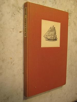
The State of California, a Medico-Geographical Account
Publicado por John J. Newbegin, San Francisco, 1939
Librería: Craftsbury Antiquarian Books, Craftsbury Common, VT, Estados Unidos de America
Valoración del vendedor:
Libro
Hardcover. Condición: Fine. endpaper map of California, and photo image of the German original Ilustrador. Limited Edition. Original light orange cloth with paper label of a sailing ship on the front board and a paper title on the spine. Number 206 of only 250 copies printed by the Ward Ritchie Press. Very clean and tight inside and out. Dr. Praslow arrived from Germany and describes the early growth of San Francisco, medical problems, the gold rush, and California geography. A thorough preface by Frederick Cordes. Spine is sunned.
-
Freeway system: Los Angeles & Vicinity
Publicado por Automobile Club of Southern California, Los Angeles [ca. 1960]
Librería: Vashon Island Books, Vashon, WA, Estados Unidos de America
Valoración del vendedor:
Original o primera edición
Paperback. Condición: Very Good. Two Color Maps Ilustrador. First Edition. An interesting Automobile Club of Southern California printing of maps of the Freeway System. Printed on glossy stock, 4to, 4pp. Includes an introductory statement about the freeway and using the maps, plus a two page spread map of the entire region as well as a single page map covering the Downtown portion of the system. Size: 4to - over 9ľ" - 12" tall. Book.
-
EUTROPHICATION A REVIEW PUBLICATION NO.34
Publicado por A REPORT TO THE STATE WATER QUALITY CONTROL BOARD, CALIFORNIA,
Librería: Terrace Horticultural Books, St. Paul, MN, Estados Unidos de America
Miembro de asociación: ABAA ILAB
Valoración del vendedor:
Paperback. Condición: VERY GOOD. EXTENSIVE BIBLIOGRAPHY, MAP OF CALIFORNIA Ilustrador. PUBLICATION NO.34. Copyright Date: 1967 Quarto, , PP.188, COVER MARKED COMPLIMENTS K. M. STEWART, DANIEL JACKSONS COPY; PRESENTATION LETTER FROM THE UNIVERSITY OF WISCONSIN WATER RESOURCES CENTER, DIRECTOR ROHLICH.
-
The Amateur Emigrant & Silverado Squatters
Publicado por Folio Society, London, 1991
Librería: Dorley House Books, Inc., Hagerstown, MD, Estados Unidos de America
Valoración del vendedor:

Hardcover. Condición: Near Fine. Estado de la sobrecubierta: No Jacket as Issued. Maps on End Papers; frontis of a young Stevenson in 1880 in California, 26 other b&w Illustrations Ilustrador. 2nd printing (1993); pictorial red c w/gilt titles; 231clean, unmarked pages Size: 4 vo.
-
CALIFORNIA OFFICIAL HIGHWAY MAP, 1966 *
Publicado por CALIFORNIA Department of Public Works; H. M. Gousha Company., * * * * *, 1966
Librería: L. Michael, North Hollywood, CA, Estados Unidos de America
Valoración del vendedor:
Mapa
Soft cover. Condición: Very Good. H. M. Gousha Company. 1966 Map: Very Good/, Ilustrador. Map: Very Good/, $54.53 CALIFORNIA OFFICIAL HIGHWAY MAP, 1966 CALIFORNIA Department of Public Works. CALIFORNIA Department of Public Works; H. M. Gousha Company. 1966 Folding Road Map Of California, 1965, In: Very Good/, Condition, Child`s Scribbling Graffiti On Covers. Description Applies To This Map, ONLY. This Map Is Hard To Find, Will Be Packaged And Shipped Carefully, To Avoid Shipping Damage And Will Make It, An Excellent Addition To Your Own Personal Library Collection, Or As A Gift. WORLD WIDE SHIPPING, AVAILABLE.
-
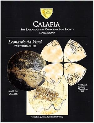
Calafia: The Journal of the California Map Society (September 2019)
Publicado por California Map Society, 2019
Librería: Diatrope Books, Berkeley, CA, Estados Unidos de America
Miembro de asociación: IOBA
Valoración del vendedor:
Libro
Paperback. Condición: Very Good. Unmarked. Beautifully illustrated. Features Leonardo da Vinci's World Map by Christopher Tyler, A Map Colorist's Tale by Dorothy Raphaely, Maps of the American Colonial Frontier by Ken Habeeb, and more. 51p.
-
![Imagen del vendedor de Index to geologic maps of California, 1957-1960 Volume No.52A (1962) [LeatherBound] a la venta por True World of Books](https://pictures.abebooks.com/inventory/md/md31657354160.jpg)
Index to geologic maps of California, 1957-1960 Volume No.52A (1962) [LeatherBound]
Ańo de publicación: 2023
Libro Impresión bajo demanda
LeatherBound. Condición: New. LeatherBound edition. Condition: New. Reprinted from 1962 edition. Leather Binding on Spine and Corners with Golden leaf printing on spine. Bound in genuine leather with Satin ribbon page markers and Spine with raised gilt bands. A perfect gift for your loved ones. NO changes have been made to the original text. This is NOT a retyped or an ocr'd reprint. Illustrations, Index, if any, are included in black and white. Each page is checked manually before printing. As this print on demand book is reprinted from a very old book, there could be some missing or flawed pages, but we always try to make the book as complete as possible. Fold-outs, if any, are not part of the book. If the original book was published in multiple volumes then this reprint is of only one volume, not the whole set. Sewing binding for longer life, where the book block is actually sewn (smythe sewn/section sewn) with thread before binding which results in a more durable type of binding. Pages: 74 Volume No.52A Koenig, James B,Strand, R. G.ph G. Index to geologic maps of California to December 31, 1956,Strand, R. G. Index to geologic maps of California to December 31, 1956.
-
Initial Reports of the Deep Sea Drilling Project Volume LVIII Covering Leg 58 of the Cruises of the Drilling Vessel Glomar Challenger Yokohama, Japan to Okinawa, Japan December 1977 - January 1978
Publicado por Government Printing Office, 1980
Librería: Ahab Books, Glencoe, CA, Estados Unidos de America
Valoración del vendedor:
Hard Cover. Condición: Very Good. No Jacket. Photographs, Diagrams, Maps and Charts Ilustrador. Four folded charts in a pocket in back. Size: 4to - over 9ľ" - 12" tall.
-
Central California. Pleasure land for the tourist. Exposition map.
Publicado por Tourist Association of Central California, 525 Market St., [1915]., San Francisco:, 1915
Librería: Zephyr Used & Rare Books, Vancouver, WA, Estados Unidos de America
Miembro de asociación: ABAA CBA ESA ILAB
Valoración del vendedor:
Original o primera edición
Oblong folio (24.5 x 9 in.). Map broadside which folds into 5 panels, double-sided, large green colour tinted map of the Exposition grounds, tinted photos of California attractions (minor dustsoiling, shelfwear, 1 very small closed tear), VG copy. First edition of this promotional brochure map promoting the surrounding tourist spots adjunct to the Panama-Pacific Exposition in San Francisco, including visits to San Jose, Monterey, Carmel, San Mateo, Oakland, Berkeley, Mt. Tamalpais, Muir Woods, Napa Valley, and more.
-
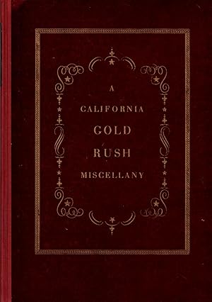
A California Gold Rush Miscellany Comprising: The Original Journal of Alexander Barrington, Nine Unpublished Letters from the Gold Mines
Publicado por The Grabhorn Press, San Francisco, CA, 1934
Librería: Clausen Books, RMABA, Colorado Springs, CO, Estados Unidos de America
Miembro de asociación: IOBA RMABA
Valoración del vendedor:
Original o primera edición
Cloth Spine. Condición: Very Good+. Early maps and Towns from California Lithographs Reproductions Ilustrador. First Edition. One of 550 copies of the Limited First Edition. Lightly aged textblock, else clean and tight. Peeling to the board corners, rubbed edges, light wear to head and foot of spine. Very bright and clean spine label, unfaded, unlike most other copies; 45p. Size: 4to - Over 9 ľ" -12" Tall. Hardcover.
-
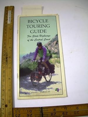
Bicycle Touring Guide : For State Highways of the Central Coast : Caltrans District 05 (Bicycle touring, Maps, campgrounds, Local sites, geared for Touring By Bike, Motorcycle maybe too)
Publicado por Caltrans, Undated, Interior Clean and Unmarked
Librería: GREAT PACIFIC BOOKS, Ventura, CA, Estados Unidos de America
Valoración del vendedor:
Soft Cover / Tall Chapbook. Condición: Good Clean Cond. Estado de la sobrecubierta: No Dust Jacket. Illustrated with Maps, and Signs Ilustrador. 56 pages Paperback : soft cover edition in good clean condition, a typical used book with some slight wear to edges and spine. As to be expected some minor bumping or creases or scuffs. Overall a good copy of this title. Excellent for reading on the subject. Or a good book to enjoy and keep on hand for yourself. Consider making it the ideal gift for the fan / enthusiast / reader in your life. Reading is one of life's the great pleasures. Inquire for further details. Thanks for viewing our items. Book.