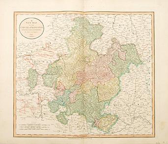
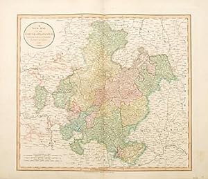
A New Map of the Circle of Franconia. from the latest authorities.
CARY, John.
Librería: Peter Harrington. ABA/ ILAB., London, Reino Unido
Librería en AbeBooks desde: 26 de julio de 1999
Ver los artículos de este vendedor
Cantidad disponible: 1Librería: Peter Harrington. ABA/ ILAB., London, Reino Unido
Librería en AbeBooks desde: 26 de julio de 1999
Ver los artículos de este vendedor
Cantidad disponible: 1Descripción
John Cary was a prolific English map seller and engraver, with premises in The Strand in London. He also made globes and scientific instruments. This is his accurate and pleasant map of Franconia. The title is taken from an ancient Germanic tribe; 'The Franks'. Franconia is divided into three specific regions; Lower, Middle and Upper. This map displays the very latest information and discoveries. Published in Cary's 'New Universal Atlas'. Size: 535 x 630 mm. Copperplate engraving in full original wash colour. Fine condition. N° de ref. del artículo 64056
Detalles bibliográficos
Título: A New Map of the Circle of Franconia. from ...
Editorial: London. 1808
Descripción de la librería
Ver la página web de la librería
All major credit cards are accepted. Both UK pounds and US dollars (exchange rate to be agreed) accepted. Books may be returned within 14 days of purchase for any reason, but please notify first of returned goods.
All shipped items are expertly packed and fully insured. All books to be sent by Recorded Delivery (UK) or signed-for Air Mail (overseas) service. UPS Express shipping also available. Packaging and insurance costs are included. Orders usually ship within 2 business days. Shipping costs are based on books weighing 2.2 LB, or 1 KG. If your book order is heavy or oversized, we may contact you to let you know extra shipping is required.
Métodos de pago
aceptados por la librería
Cheque Giro Postal Letra de Cambio Transferencia Bancaria