Descripción
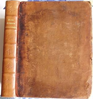
London: Printed for J. Knox: 1766, Second edition, 4to., xvi, 357pp. + errata leaf, finely engraved map frontispiece showing An Accurate Map of the Island of Anglesey, drawn and engraved by J. Gibson, The Coast Surveyed by Lewis Morris, 12 fine engraved copper plates (complete), plates are numbered 1 to XIII however as there never was a plate X ever printed, bound in contemporary full calf with professionally rebacked modern calf spine blindstamped in compartments with gilt title, some rubbing and wear to along extreme outer edges unaffecting contents. A generally VG+ internally clean copy of this important work. Ex Libris Will Worthington D.D. with his finely engraved bookplate to upper pastedown. Henry Rowlands (1655-1723) was born on Anglesey at Llanedwen and became rector of Llanidan Old Church. He wrote about farming practice in Idea Agriculturæ (written in 1704 and first published, posthumously, in 1764) and in 1710 produced, in Latin, Antiquitates Parochiales about the ancient monuments of the locality. His best known work was Mona Antiqua Restaurata (1723) literally Ancient Anglesey restored in which he mistakenly linked the island s Bronze Age sites with the Druids, the priests and lawgivers of the ancient Celts. This fanciful anachronism, compounded by the English antiquarian William Stukeley, was seized upon in Victorian times and still persists today. However Rowlands does deserve credit for focussing attention on the island s ancient sites. This second and improved edition of Mona Antiqua, edited by Dr Henry Owen (1717-95), was issued in 1766. N° de ref. del artículo 3297
Contactar al vendedor
Denunciar este artículo
![]()
