Descripción
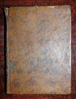
24mo., (5 x 3 6/8 inches). Engraved title-page, fine folding engraved map of the Americas, 30 full-page maps and 7 plans, (this copy bound without portrait of Ferdinand VI and dedication to him) a few plans and maps slightly cropped, but not affecting the image ). Contemporary Spanish mottled calf, the spine in five compartments with four raised bands, (the head of the spine chipped with minor loss, extremities scuffed). A RARE AND ATTRACTIVE ATLAS OF SPANISH AMERICA. With two maps of California, one of Florida, and an early map of Texas, entitled ''Pays de los Teguas''. The accompanying text provides information on the natural resources of the areas. Most of the maps and plans are by Lopez himself, and he drew them on different scales so they would all be the same size. Lopez was one of Spain's most reknowned cartographers. He spent his early years in Paris as the pupil of the great French cartographer Jean-Baptiste Bourguignon d'Anville, but in 1760 was recalled to Spain and became Royal Geographer to King Charles III, with the task of mapping all the different regions of Spain. In preparation for such a great task he sent out a questionnaire to parishes, asking them for information on their local area. These regional maps were intended to accompany his ambitious work "Diccionario Geográfico-Histórico de España", which was sadly never completed. Medina (BHA) IV, 3859; Palau 140284; Sabin 41999. Catalogued by Kate Hunter. N° de ref. del artículo 72lib1262
Contactar al vendedor
Denunciar este artículo
![]()


