Importe total (1 artículo artículos):
Destino del pedido:

map turkey europe illustrating berlin (3 resultados)
Ir a los resultados principales
Tipo de artículo
- Todo tipo de artículos
- Libros (2)
- Revistas y publicaciones
- Cómics
- Partituras
- Arte, grabados y pósters
- Fotografías
- Mapas (1)
-
Manuscritos y
coleccionismo de papel
Condición
- Todo
- Nuevos
- Antiguos o usados
Encuadernación
- Todo
- Tapa dura
- Tapa blanda
Más atributos
- Primera edición
- Firmado
- Sobrecubierta
- Con imágenes del vendedor
- Sin impresión bajo demanda
Ubicación del vendedor
Valoración de los vendedores
-
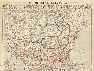
Map of Turkey in Europe Illustrating the Berlin Congress Treaty, July, 1878
Publicado por Michell's New General Atlas, 1879
Librería: Eureka Books, Eureka, CA, Estados Unidos de America
Valoración del vendedor:

Map. Map, 14.25 x 19.5 inches on sheet 15.25 x 23 inches, with usual grapevine border, in color. Berlin Congress was a diplomatic congress to reorganize the states in the Balkan peninsula after the Russo-Turkish war of 1877-1878, won by Russia. The decisions made were not a success for peace in the area with most participants unsatisfied with the outcome. The dissatisfaction contributed to the causes of WWI. First edition (first printing). A near fine copy with short closed tear at left fold. Two-page map folded in center, page 114, 1/2.
-
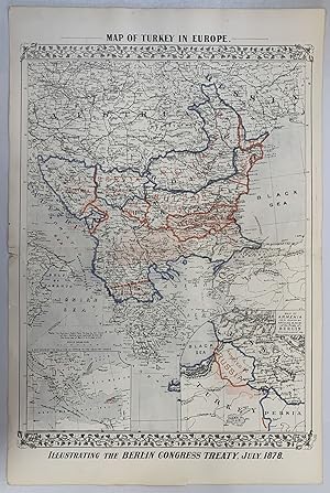
Map of Turkey in Europe Illustrating the Berlin Congress Treaty, July, 1878
Publicado por Mitchell's, Philadelphia, 1879
Librería: Main Street Fine Books & Mss, ABAA, Galena, IL, Estados Unidos de America
Miembro de asociación: ABAA ILAB MWABA
Valoración del vendedor:
Mapa
15" X 23Ľ" (image 14Ľ" X 20˝"). Printed coloring. Near fine. Single center fold (as issued). Attractive example of this large map bearing printed border coloring. Small inset at lower left features "A Map Showing the Relation of Cyprus to the Adjacent Coasts" and larger inset at lower left features "Map of Armenia to illustrate Articles 58, 59, 60 of the Treaty of Berlin." Quite interesting and in lovely condition.
-
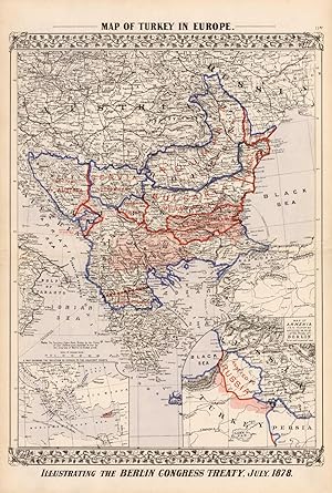
Map of Turkey in Europe- Illustrating the Berlin Congress Treaty, July 1878
Ańo de publicación: 1878
Librería: Art Source International Inc., Boulder, CO, Estados Unidos de America
Valoración del vendedor:

This map of Turkey in Europe was produced by Augustus Mitchell in 1878 for his New General Atlas. Highlights of this map are Mitchells traditional grapevine border and abundant details of geographical features. This 1878 map offers a fascinating perspective of areas that have since undergone significant growth and change, in addition to the value as great examples of Mitchell's classic mapmaking style. This map measures 1 inches by 1 inches.