
Importe total (1 artículo artículos):
Destino del pedido:

atlantic pilot atlas de clarke james (25 resultados)
Ir a los resultados principales
Tipo de artículo
- Todo tipo de artículos
- Libros (25)
- Revistas y publicaciones
- Cómics
- Partituras
- Arte, grabados y pósters
- Fotografías
- Mapas
-
Manuscritos y
coleccionismo de papel
Condición
Encuadernación
- Todo
- Tapa dura
- Tapa blanda
Más atributos
- Primera edición (1)
- Firmado
- Sobrecubierta
- Con imágenes del vendedor (1)
- Sin impresión bajo demanda
Ubicación del vendedor
Valoración de los vendedores
-
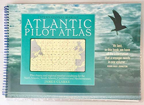
Atlantic Pilot Atlas: Pilot Charts and Regional Weather Conditions for the North Atlantic, South Atlantic, Caribbean and Mediterranean
Publicado por Intl Marine, 1989
ISBN 10: 0877429960ISBN 13: 9780877429968
Librería: A Book Preserve, Columbus, OH, Estados Unidos de America
Valoración del vendedor:

Libro Original o primera edición
Soft cover. Condición: Near Fine. 1st Edition. Near fine large format spiral bound soft cover. 11.5 X 16.5 in. Conventiently lays flat on table. 74 pp. Charts; maps. NO ownership markings or discernable flaws. Comes with clear protective plastic sleeve. Ships fast with tracking.
-

Atlantic Pilot Atlas
Publicado por Intl Marine Pub Co, 1997
ISBN 10: 007011921XISBN 13: 9780070119215
Librería: Wonder Book, Frederick, MD, Estados Unidos de America
Miembro de asociación: ABAA ILAB
Valoración del vendedor:
Libro
Condición: Very Good. Very Good condition. 2nd edition. A copy that may have a few cosmetic defects. May also contain light spine creasing or a few markings such as an owner's name, short gifter's inscription or light stamp.
-
Atlantic Pilot Atlas: Pilot Charts and Regional Weather Conditions for the North Atlantic, South Atlantic, Caribbean and Mediterranean
Publicado por Intl Marine Pub Co, 1997
ISBN 10: 007011921XISBN 13: 9780070119215
Libro
Condición: VeryGood. Most items will be dispatched the same or the next working day.
-
Atlantic Pilot Atlas Including the Caribbean Mediterranean
Publicado por Bloomsbury Publishing PLC, 2011
ISBN 10: 1408122472ISBN 13: 9781408122471
Librería: PBShop.store US, Wood Dale, IL, Estados Unidos de America
Valoración del vendedor:
Libro
PAP. Condición: New. New Book. Shipped from UK. Established seller since 2000.
-
Atlantic Pilot Atlas
Publicado por Adlard Coles, 2010
ISBN 10: 1408122472ISBN 13: 9781408122471
Librería: Midtown Scholar Bookstore, Harrisburg, PA, Estados Unidos de America
Valoración del vendedor:
Libro
Spiral-bound. Condición: Good. Jumbo-sized. Good - Bumped and creased book with tears to the extremities, but not affecting the text block, may have remainder mark or previous owner's name - GOOD.
-
Atlantic Pilot Atlas
Publicado por Bloomsbury Publishing PLC, 2011
ISBN 10: 1408122472ISBN 13: 9781408122471
Librería: Kennys Bookshop and Art Galleries Ltd., Galway, GY, Irlanda
Valoración del vendedor:
Libro
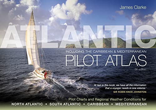
Condición: New. 2011. 5th Edition. Spiral-bound. A guide to the weather of the North and South Atlantic, the Mediterranean and the Caribbean - 40 colour charts show likely winds, currents, gale frequencies, rough sea conditions, hurricane tracks and recommended sailing routes for each month of the year. Num Pages: 80 pages, Over 40 colour charts and diagrams. BIC Classification: 1QSA; TRLN; WSSN. Category: (G) General (US: Trade). Dimension: 431 x 296 x 60. Weight in Grams: 1050. 80 pages, Over 40 colour charts and diagrams. A guide to the weather of the North and South Atlantic, the Mediterranean and the Caribbean - 40 colour charts show likely winds, currents, gale frequencies, rough sea conditions, hurricane tracks and recommended sailing routes for each month of the year. Cateogry: (G) General (US: Trade). BIC Classification: 1QSA; TRLN; WSSN. Dimension: 431 x 296 x 60. Weight: 1050. . . . . .
-
Atlantic Pilot Atlas
Publicado por Bloomsbury Publishing PLC, 2010
ISBN 10: 1408122472ISBN 13: 9781408122471
Librería: THE SAINT BOOKSTORE, Southport, Reino Unido
Valoración del vendedor:
Libro
Paperback / softback. Condición: New. New copy - Usually dispatched within 4 working days. A guide to the weather of the North and South Atlantic, the Mediterranean and the Caribbean - 40 colour charts show likely winds, currents, gale frequencies, rough sea conditions, hurricane tracks and recommended sailing routes for each month of the year.
-
Atlantic Pilot Atlas: Including the Caribbean & Mediterranean
Publicado por Adlard Coles 2011-02-28, 2011
ISBN 10: 1408122472ISBN 13: 9781408122471
Libro
Paperback. Condición: New.
-
Atlantic Pilot Atlas
Publicado por Adlard Coles, 2010
ISBN 10: 1408122472ISBN 13: 9781408122471
Librería: GF Books, Inc., Hawthorne, CA, Estados Unidos de America
Valoración del vendedor:
Libro
Condición: Good. Book is in Used-Good condition. Pages and cover are clean and intact. Used items may not include supplementary materials such as CDs or access codes. May show signs of minor shelf wear and contain limited notes and highlighting. 2.29.
-
Atlantic Pilot Atlas (Paperback)
Publicado por Bloomsbury Publishing PLC, London, 2011
ISBN 10: 1408122472ISBN 13: 9781408122471
Librería: Grand Eagle Retail, Wilmington, DE, Estados Unidos de America
Valoración del vendedor:
Libro
Paperback. Condición: new. Paperback. The Atlantic Pilot Atlas provides a complete guide to the weather of the North and South Atlantic, the Mediterranean and the Caribbean.Now revised for the fifth edition, it includes weather forecasting, global warming and hurricane avoidance information as well as wind and current charts, wave heights, tropical cyclone tracks and shipping routes. Any skipper contemplating an ocean crossing needs to know what conditions he is likely to meet en route, in order to plan a safe and comfortable passage, and this book provides exactly what is needed.40 specially drawn colour charts show detailed information on the winds, currents, gale frequencies, rough sea conditions, hurricane tracks and recommended sailing routes for each month of the year for all these oceans.'This is what every yachtsman contemplating an extended cruise needs in one book. No serious offshore bookshelf should be without one.' Yachting Monthly'Without doubt the most useful guide for anyone planning a Transatlantic voyage.' Ships & Ports A guide to the weather of the North and South Atlantic, the Mediterranean and the Caribbean - 40 colour charts show likely winds, currents, gale frequencies, rough sea conditions, hurricane tracks and recommended sailing routes for each month of the year. Shipping may be from multiple locations in the US or from the UK, depending on stock availability.
-
Atlantic Pilot Atlas Including the Caribbean Mediterranean
Publicado por Bloomsbury Publishing PLC, 2011
ISBN 10: 1408122472ISBN 13: 9781408122471
Librería: PBShop.store UK, Fairford, GLOS, Reino Unido
Valoración del vendedor:
Libro
PAP. Condición: New. New Book. Shipped from UK. Established seller since 2000.
-
Atlantic Pilot Atlas
Publicado por Bloomsbury Publishing (UK) 2011-02-28, London, 2011
ISBN 10: 1408122472ISBN 13: 9781408122471
Libro
paperback. Condición: New. Language: ENG.
-
Atlantic Pilot Atlas
Publicado por A & C Black Publishers Ltd., 2010
ISBN 10: 1408122472ISBN 13: 9781408122471
Libro
Condición: New. pp. 80.
-
Atlantic Pilot Atlas
Publicado por Bloomsbury Publishing PLC, 2010
ISBN 10: 1408122472ISBN 13: 9781408122471
Librería: Kennys Bookstore, Olney, MD, Estados Unidos de America
Valoración del vendedor:

Libro
Condición: New. 2011. 5th Edition. Spiral-bound. A guide to the weather of the North and South Atlantic, the Mediterranean and the Caribbean - 40 colour charts show likely winds, currents, gale frequencies, rough sea conditions, hurricane tracks and recommended sailing routes for each month of the year. Num Pages: 80 pages, Over 40 colour charts and diagrams. BIC Classification: 1QSA; TRLN; WSSN. Category: (G) General (US: Trade). Dimension: 431 x 296 x 60. Weight in Grams: 1050. 80 pages, Over 40 colour charts and diagrams. A guide to the weather of the North and South Atlantic, the Mediterranean and the Caribbean - 40 colour charts show likely winds, currents, gale frequencies, rough sea conditions, hurricane tracks and recommended sailing routes for each month of the year. Cateogry: (G) General (US: Trade). BIC Classification: 1QSA; TRLN; WSSN. Dimension: 431 x 296 x 60. Weight: 1050. . . . . . Books ship from the US and Ireland.
-
Atlantic Pilot Atlas: Including the Caribbean & Mediterranean
Publicado por Adlard Coles, 2011
ISBN 10: 1408122472ISBN 13: 9781408122471
Libro
Spiral-bound. Condición: Brand New. 5th spi edition. 76 pages. 11.50x16.75x0.75 inches. In Stock.
-
Atlantic Pilot Atlas
Publicado por Adlard Coles, 2010
ISBN 10: 1408122472ISBN 13: 9781408122471
Librería: GoldBooks, Denver, CO, Estados Unidos de America
Valoración del vendedor:
Libro
Paperback. Condición: very good. Very Good Copy. Customer Service Guaranteed.
-
Atlantic Pilot Atlas (Paperback)
Publicado por Bloomsbury Publishing PLC, London, 2011
ISBN 10: 1408122472ISBN 13: 9781408122471
Libro
Paperback. Condición: new. Paperback. The Atlantic Pilot Atlas provides a complete guide to the weather of the North and South Atlantic, the Mediterranean and the Caribbean.Now revised for the fifth edition, it includes weather forecasting, global warming and hurricane avoidance information as well as wind and current charts, wave heights, tropical cyclone tracks and shipping routes. Any skipper contemplating an ocean crossing needs to know what conditions he is likely to meet en route, in order to plan a safe and comfortable passage, and this book provides exactly what is needed.40 specially drawn colour charts show detailed information on the winds, currents, gale frequencies, rough sea conditions, hurricane tracks and recommended sailing routes for each month of the year for all these oceans.'This is what every yachtsman contemplating an extended cruise needs in one book. No serious offshore bookshelf should be without one.' Yachting Monthly'Without doubt the most useful guide for anyone planning a Transatlantic voyage.' Ships & Ports A guide to the weather of the North and South Atlantic, the Mediterranean and the Caribbean - 40 colour charts show likely winds, currents, gale frequencies, rough sea conditions, hurricane tracks and recommended sailing routes for each month of the year. Shipping may be from our UK warehouse or from our Australian or US warehouses, depending on stock availability.
-
Atlantic Pilot Atlas
Publicado por Adlard Coles, 2010
ISBN 10: 1408122472ISBN 13: 9781408122471
Librería: GoldenWavesOfBooks, Fayetteville, TX, Estados Unidos de America
Valoración del vendedor:
Libro
Paperback. Condición: new. New. Fast Shipping and good customer service.
-
Atlantic Pilot Atlas
Publicado por Adlard Coles, 2010
ISBN 10: 1408122472ISBN 13: 9781408122471
Librería: Wizard Books, Long Beach, CA, Estados Unidos de America
Valoración del vendedor:
Libro
Paperback. Condición: new. New.
-
Atlantic Pilot Atlas
Publicado por Adlard Coles, 2010
ISBN 10: 1408122472ISBN 13: 9781408122471
Librería: Grumpys Fine Books, Tijeras, NM, Estados Unidos de America
Valoración del vendedor:
Libro
Paperback. Condición: new. Prompt service guaranteed.
-
Atlantic Pilot Atlas (Paperback)
Publicado por Bloomsbury Publishing PLC, London, 2011
ISBN 10: 1408122472ISBN 13: 9781408122471
Librería: AussieBookSeller, Truganina, VIC, Australia
Valoración del vendedor:
Libro
Paperback. Condición: new. Paperback. The Atlantic Pilot Atlas provides a complete guide to the weather of the North and South Atlantic, the Mediterranean and the Caribbean.Now revised for the fifth edition, it includes weather forecasting, global warming and hurricane avoidance information as well as wind and current charts, wave heights, tropical cyclone tracks and shipping routes. Any skipper contemplating an ocean crossing needs to know what conditions he is likely to meet en route, in order to plan a safe and comfortable passage, and this book provides exactly what is needed.40 specially drawn colour charts show detailed information on the winds, currents, gale frequencies, rough sea conditions, hurricane tracks and recommended sailing routes for each month of the year for all these oceans.'This is what every yachtsman contemplating an extended cruise needs in one book. No serious offshore bookshelf should be without one.' Yachting Monthly'Without doubt the most useful guide for anyone planning a Transatlantic voyage.' Ships & Ports A guide to the weather of the North and South Atlantic, the Mediterranean and the Caribbean - 40 colour charts show likely winds, currents, gale frequencies, rough sea conditions, hurricane tracks and recommended sailing routes for each month of the year. Shipping may be from our Sydney, NSW warehouse or from our UK or US warehouse, depending on stock availability.
-
Atlantic Pilot Atlas
Publicado por Adlard Coles, 2010
ISBN 10: 1408122472ISBN 13: 9781408122471
Librería: Front Cover Books, Denver, CO, Estados Unidos de America
Valoración del vendedor:
Libro
Condición: new.
-
Atlantic Pilot Atlas
Publicado por Adlard Coles, 2010
ISBN 10: 1408122472ISBN 13: 9781408122471
Librería: GoldBooks, Denver, CO, Estados Unidos de America
Valoración del vendedor:
Libro
Paperback. Condición: new. New Copy. Customer Service Guaranteed.
-
Atlantic Pilot Atlas
Publicado por Adlard Coles, 2010
ISBN 10: 1408122472ISBN 13: 9781408122471
Librería: GoldenDragon, Houston, TX, Estados Unidos de America
Valoración del vendedor:
Libro
Paperback. Condición: new. Buy for Great customer experience.
-
Atlantic Pilot Atlas
Publicado por Adlard Coles, 2010
ISBN 10: 1408122472ISBN 13: 9781408122471
Librería: Big Bill's Books, Wimberley, TX, Estados Unidos de America
Valoración del vendedor:
Libro
Paperback. Condición: new. Brand New Copy.