
Importe total (1 artículo artículos):
Destino del pedido:

9780850541137 - Hull (Hessle Road) 1928: Yorkshire Sheet 240.06 (Old O.S. Maps of Yorkshire) de Credland, Arthur G. (12 resultados)
Ir a los resultados principales
Tipo de artículo
- Todo tipo de artículos
- Libros (9)
- Revistas y publicaciones
- Cómics
- Partituras
- Arte, grabados y pósters
- Fotografías
- Mapas (3)
-
Manuscritos y
coleccionismo de papel
Condición
Encuadernación
Más atributos
- Primera edición
- Firmado
- Sobrecubierta
- Con imágenes del vendedor (2)
- Sin impresión bajo demanda
Ubicación del vendedor
Valoración de los vendedores
-
Hull (Hessle Road) 1928: Yorkshire Sheet 240.06 (Old O.S. Maps of Yorkshire)
Publicado por Alan Godfrey Maps, 1987
ISBN 10: 0850541131ISBN 13: 9780850541137
Librería: WorldofBooks, Goring-By-Sea, WS, Reino Unido
Valoración del vendedor:

Libro
Paperback. Condición: Very Good. The book has been read, but is in excellent condition. Pages are intact and not marred by notes or highlighting. The spine remains undamaged.
-
Hull (Hessle Road) 1928
Publicado por Alan Godfrey Maps 1987-08-01, 1987
ISBN 10: 0850541131ISBN 13: 9780850541137
Libro
hardback. Condición: New. Language: ENG.
-
Hull Hessle Road 1928 Yorkshire Sheet 24006 Old OS Maps of Yorkshire
Publicado por Alan Godfrey Maps, 1987
ISBN 10: 0850541131ISBN 13: 9780850541137
Librería: PBShop.store US, Wood Dale, IL, Estados Unidos de America
Valoración del vendedor:
Libro
UNK. Condición: New. New Book. Shipped from UK. Established seller since 2000.
-
Hull (Hessle Road) 1928: Yorkshire Sheet 240.06 (Old O.S. Maps of Yorkshire)
Publicado por Alan Godfrey Maps, 1987
ISBN 10: 0850541131ISBN 13: 9780850541137
Mapa
Map. Condición: Brand New. 8.27x4.72x0.16 inches. In Stock.
-
Hull (Hessle Road) 1928: Yorkshire Sheet 240.06
Publicado por Alan Godfrey Maps, 1987
ISBN 10: 0850541131ISBN 13: 9780850541137
Librería: THE SAINT BOOKSTORE, Southport, Reino Unido
Valoración del vendedor:
Libro
Sheet map, folded. Condición: New. New copy - Usually dispatched within 4 working days.
-
Hull (Hessle Road) 1928: Yorkshire Sheet 240.06 (Old O.S. Maps of Yorkshire)
Publicado por Alan Godfrey Maps, 1987
ISBN 10: 0850541131ISBN 13: 9780850541137
Mapa
Map. Condición: Brand New. 8.27x4.72x0.16 inches. In Stock.
-
Hull (Hessle Road) 1928: Yorkshire Sheet 240.06 (Old O.S. Maps of Yorkshire)
Publicado por Alan Godfrey Maps, 1987
ISBN 10: 0850541131ISBN 13: 9780850541137
Librería: Kennys Bookstore, Olney, MD, Estados Unidos de America
Valoración del vendedor:

Libro
Condición: New. 1987. Facsim.of 1928 Ed. Map. Series: Old O.S. Maps of Yorkshire. BIC Classification: 1DBKEYK; 3JJG; WQH; WTRM. Category: (G) General (US: Trade). Dimension: 210 x 121 x 2. Weight in Grams: 24. Yorkshire Sheet 240.06. Series: Old O.S. Maps of Yorkshire. Cateogry: (G) General (US: Trade). BIC Classification: 1DBKEYK; 3JJG; WQH; WTR. Dimension: 210 x 121 x 2. Weight: 24. . . . . . Books ship from the US and Ireland.
-
Hull (Hessle Road) 1928: Yorkshire Sheet 240.06 (Old O.S. Maps of Yorkshire)
Publicado por Alan Godfrey Maps, 1987
ISBN 10: 0850541131ISBN 13: 9780850541137
Librería: Kennys Bookshop and Art Galleries Ltd., Galway, GY, Irlanda
Valoración del vendedor:
Libro
Condición: New. 1987. Facsim.of 1928 Ed. Map. Series: Old O.S. Maps of Yorkshire. BIC Classification: 1DBKEYK; 3JJG; WQH; WTRM. Category: (G) General (US: Trade). Dimension: 210 x 121 x 2. Weight in Grams: 24. Yorkshire Sheet 240.06. Series: Old O.S. Maps of Yorkshire. Cateogry: (G) General (US: Trade). BIC Classification: 1DBKEYK; 3JJG; WQH; WTR. Dimension: 210 x 121 x 2. Weight: 24. . . . . .
-
Hull (Hessle Road) 1928 : Yorkshire Sheet 240.06
Publicado por Alan Godfrey Maps Aug 1987, 1987
ISBN 10: 0850541131ISBN 13: 9780850541137
Libro
Karte. Condición: Neu. Neuware Deutsch.
-
Hull Hessle Road 1928 Yorkshire Sheet 24006 Old OS Maps of Yorkshire
Publicado por Alan Godfrey Maps, 1987
ISBN 10: 0850541131ISBN 13: 9780850541137
Librería: PBShop.store UK, Fairford, GLOS, Reino Unido
Valoración del vendedor:
Libro
UNK. Condición: New. New Book. Shipped from UK. Established seller since 2000.
-
Hull (Hessle Road) 1928: Yorkshire Sheet 240.06 (Old O.S. Maps of Yorkshire)
Publicado por Alan Godfrey Maps, 1987
ISBN 10: 0850541131ISBN 13: 9780850541137
Librería: GENERATIONS GONE BY, Manchester, Reino Unido
Valoración del vendedor:
Mapa
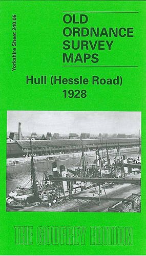
No Binding. Condición: New. No Jacket. Here are the details of maps for Hull (Hessle Road): Yorks Sheet 240.06a Hull (Hessle Road) 1890 - published 2012; intro by Susan Neave. ISBN.978-1-84784-577-1 Yorks Sheet 240.06b Hull (Hessle Road) 1928 - published 1987; intro by A G Credland. ISBN.978-0-85054-113-7 We have published 2 versions of this map, showing how the area changed across the years. The 1890 version is in full colour, taken from the beautiful handcoloured 1st Edition OS map. The maps cover the southern area of Hull along Hessle Road and including several of the docks. Coverage stretches from Hawthorn Avenue eastward to the Albert Dock Basin, and from Woodcock Street southward to the Humber. Vast numbers of tiny, close-knit terraces are a major feature of the map, each house (many of which were bombed in the war) neatly delineated. Features include Holy Trinity Burial Ground, tramways and depot, St Andrew's Dock, William Wright Dock incl graving dock, Albert Dock, Neptune Street station, many warehouses and sidings with full track layout given, St James church, Billingsgate goods station, Subway Junction, St Barnabas church, wagon works, etc. Adjacent sheet 240.07 is included as an inset. On the reverse we include selections of directory entries, that for the 1890 map including the St Andrew's Dock entry. The map links up with Sheets 240.02 Hull (West) to the north.
-

Credland, A: Hull (Hessle Road) 1928
Publicado por Alan Godfrey Maps, 1987
ISBN 10: 0850541131ISBN 13: 9780850541137
Libro
Condición: New.