Importe total (1 artículo artículos):
Destino del pedido:

nicolas sanson guillaume (8 resultados)
Ir a los resultados principales
Tipo de artículo
- Todo tipo de artículos
- Libros (5)
- Revistas y publicaciones
- Cómics
- Partituras
- Arte, grabados y pósters
- Fotografías
- Mapas (3)
-
Manuscritos y
coleccionismo de papel
Condición
Encuadernación
Más atributos
- Primera edición (2)
- Firmado
- Sobrecubierta
- Con imágenes del vendedor (7)
- Sin impresión bajo demanda (6)
Gastos de envío gratis
Ubicación del vendedor
Valoración de los vendedores
-
Introduction A la Geographie des Srs Sanson, GĂ ographes du Roi
Publicado por Forgotten Books, 2018
ISBN 10: 0259030171ISBN 13: 9780259030171
Libro Impresión bajo demanda
Paperback. Condición: New. Print on Demand. Excerpt from Introduction A la Geographie des Srs Sanson, GĂ ographes du Roi. About the Publisher, Forgotten Books publishes hundreds of thousands of rare and classic books. This book is a reproduction of an important historical work. Forgotten Books uses state-of-the-art technology to digitally reconstruct the work, preserving the original format whilst repairing imperfections present in the aged copy. In rare cases, an imperfection in the original, such as a blemish or missing page, may be replicated in our edition. We do, however, repair the vast majority of imperfections successfully; any imperfections that remain are intentionally left to preserve the state of such historical works. This text has been digitally restored from a historical edition. Some errors may persist, however we consider it worth publishing due to the work's historical value. The digital edition of all books may be viewed on our website before purchase. print-on-demand item.
-
![Imagen del vendedor de Tavole della geografia antica, moderna, ecclesiastica e civile, o vero Divisione del globo terrestre nelle sue principali parti, regioni, regni . (1690) [LeatherBound] a la venta por True World of Books](https://pictures.abebooks.com/inventory/md/md31618918009.jpg)
Tavole della geografia antica, moderna, ecclesiastica e civile, o vero Divisione del globo terrestre nelle sue principali parti, regioni, regni . (1690) [LeatherBound]
Ańo de publicación: 2023
Libro Impresión bajo demanda
LeatherBound. Condición: NEW. LeatherBound edition. Condition: New. Reprinted from 1690 edition. Leather Binding on Spine and Corners with Golden leaf printing on spine. Bound in genuine leather with Satin ribbon page markers and Spine with raised gilt bands. A perfect gift for your loved ones. NO changes have been made to the original text. This is NOT a retyped or an ocr'd reprint. Illustrations, Index, if any, are included in black and white. Each page is checked manually before printing. As this print on demand book is reprinted from a very old book, there could be some missing or flawed pages, but we always try to make the book as complete as possible. Fold-outs, if any, are not part of the book. If the original book was published in multiple volumes then this reprint is of only one volume, not the whole set. Sewing binding for longer life, where the book block is actually sewn (smythe sewn/section sewn) with thread before binding which results in a more durable type of binding. Pages: 182.
-
AMERIQUE MERIDIONALE. Carte N. et G. Sanson, 1669.
Publicado por Pierre Mariette, 1669
Librería: Librairie l'Art et l'Affiche, Nice, Francia
Valoración del vendedor:

Mapa Original o primera edición
Pas de couverture. Condición: Trčs bon. Nicolas Sanson Ilustrador. Edition originale. Paris, chez Pierre Mariette, 1669. Carte géographique française de l'Amérique du Sud, dessinée par le cartographe français Nicolas Sanson (1600-1667) géographe ordinaire du Roy, et publiée en 1650. Cette seconde version, "revue et changée" par Guillaume Sanson (1633-1703), bien détaillée, a été publiée en 1669. Gravure : A. Peyrounin. Le lac mythique de Parime est représenté, avec sur sa côte occidentale la légendaire "Manoa dels Dora", la Cité d'Or. Rehaussée ŕ l'aquarelle. Impression : gravure sur cuivre. Papier propre, pas de taches, légčrement jauni en marge. Pli médian vertical. Légčres froissures. Dans l'ensemble, une belle carte, en bon ŕ trčs bon état. *//* Paris: Pierre Mariette, 1669. French copperplate-engraved map of South America, entitled 'Amerique Meridionale', by cartographer Nicolas Sanson (1600-1667). Initially issued in 1650, it was updated with this second version by Guillaume Sanson (1633-1703), ans reissued in 1669. This attractive map presents the continent with Sanson's characteristic attention to detail. The relatively unknown Amazon region is left with little speculation. The mythical Lac de Parime still appears with the legendary Manoa del Dora (City of Gold) on its western shore; although the lake is diminished in size from earlier depictions. Decorated with a strapwork title cartouche. Engraved by A. Peyrounin. Sharp impression, outlined in colours. The map's paper is clean, slightly yellowed on edges. Light creasing, a vertical median fold. Overall, a copy in very good condition. B+ ** France LIVRAISON par défaut STANDARD: livraison en RELAIS COLIS Chronopost. PRIORITAIRE: livraison ŕ domicile en Colissimo ou Lettre suivie ++ Selon le POIDS et la VALEUR, nous sommes susceptibles d'AJUSTER ŕ la hausse ou ŕ la baisse les frais de port // Depending on item's WEIGHT or VALUE, we may request Extra Charges, or reduce Shipping Costs **. Carte.
-

La Sainte Bible traduite en francois le latin de la Vulgate a côté, avec de courtes notes tirées des Saints Peres & des meilleurs interprétes, pour l'intelligence des endroits les plus difficiles ; et la Concorde des quatre evangelistes, en latin & en francois. Nouvelle edition, enrichie de cartes geographiques et de figures; avec les traitez de cronologie & de geographie; les sommaires des livres tant du Vieux que du Nouveau Testament ; & toutes les tables tirées de la grande Bible latine d'Antoine Vitré. De plus une Idée générale de l'Ecriture sainte, avec diférentes maniéres & diverses regles pour l'expliquer. Le tout augmenté d'une table tres-ample des matičres en françois & en latin. Tome II
Publicado por Jean Francois Broncart, Liege, 1702
ISBN 10: 2883730024ISBN 13: 9782883730021
Libro
Hardcover. Condición: Good. Nicolas Sanson d' Abbeville , Guillaume du Vivier, Jacobus Harrewijn Ilustrador. Tome II. Illustrations gravés; reliure originale mouton, dos ŕ 6 nerfs, titres et ornements dorés, pages de garde marbrés.
-
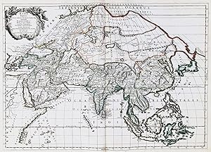
Asia Vetus" - Asia Asien Asie China Arabia India Russia Japan Korea Philippines map Karte carte
Publicado por Paris, Mariette, 1667
Librería: Antiquariat Steffen Völkel GmbH, Seubersdorf, Alemania
Miembro de asociación: ILAB VDA
Valoración del vendedor:
Mapa
Seltene großformatige altkolorierte Kupferstich-Karte von Nicolas Sanson aus dessen Atlas "Cartes Generales de toutes les parties du Monde". Dieser Atlas gilt als der erste große französische Weltatlas. -- Blattmasse ca.60,5 x44 cm. -- gut erhalten. || || Rare large-format copper engraved old-colored map by Nicolas Sanson from his atlas "Cartes Generales de toutes les parties du Monde". This atlas is considered to be the first large French world atlas. -- in good condition. || || This is an Original! - No Copy! - No Reprint! -- Original! - Kein Nachdruck! - Keine Kopie! Sprache: Französisch Gewicht in Gramm: 1550.
-
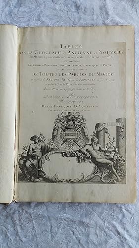
Full-Leather. Condición: Good. 106 geographical tables. This copy has tables from various editions with printing dates from 1663 to 1741. The majority of tables date from 1663-1698. Most are in French but many also in Latin. The plates show different versions of the geographical tables. Please inquire for more details. The majority of tables are 20 inches, some tables are 16 inches and are pasted on blank pages. The leather binding is worn at the top and bottom of spine and on corners and edges.
-

Le Canada, ou Nouvelle France.
Publicado por Paris: Pierre Mariette, 1656, 1656
Librería: Arader Galleries - AraderNYC, New York, NY, Estados Unidos de America
Valoración del vendedor:
Mapa
No Binding. Condición: Very Good. Copperplate map (Image: 15 1/2 x 21 1/2 in.; 39.4 x 54.6 cm), engraved by Jean Somer, partially handcolored in outline, decorative cartouche in lower right corner. BINDING/CONDITION: Matted and framed, not examined out of frame. A VERY BRIGHT AND CRISP IMPRESSION OF THE FIRST LARGE-SCALE MAP TO PRESENT ALL FIVE GREAT LAKES IN A COMPARATIVELY ACCURATE CORRELATION. "This delineation would considerably influence the cartography of the region for over 100 years; it was not to be superseded until Guillaume de L'Isle's Carte du Canada, in 1703" (Burden). Sanson's transformative map shows the entire Great Lakes region and the St. Lawrence River basin in detail. It names "L. Erie, ou du Chat" as a recognizable and distinct lake for the first time; the name derives from the native name "Derie" which referred to the "panther-like qualities of the feared local native Indians" (Burden). The northern waters remain the same with the exception of Hudson Bay, which is depicted in more detail. Sanson drew on source information from the Jesuit missionaries who ventured westward after Champlain's death and published annual accounts, or "Relations," of their findings between 1632 and 1673. This included Jean Nicollet's discovery of Lake Michigan, "Lac des Puans," in 1634 and Father Paul Ragueneau's "Relation" of 1648 which describes his visit to Niagara Falls, three decades before Father Louis Hennepin's formal description of the cataracts. Sanson also made several improvements in his east coast delineation: Long Island is introduced with New Amsterdam in its correct position. The Delaware River is more accurately shown, with "N[ouvelle] Sučde (the former Swedish colony of Fort Christina) at its mouth, the site of present-day Willmington. The borders of Virginia are defined but none of the English settlements are given. PROVENANCE: Anne H. & Frederick Vogel III (sale, Sotheby's New York, 19 January 2019, lot 1138); Martayan Lan Augustyn, New York, 2012 REFERENCES: Burden, The Mapping of North America, 318; Karpinski, Great Lakes Region,
-
Description de tout l'Univers, en plusieurs Cartes, & en divers Traitez de Geographie et d'Histoire.
Publicado por Amsterdam: François Halma, 1700., 1700
Librería: Arader Galleries - AraderNYC, New York, NY, Estados Unidos de America
Valoración del vendedor:
Original o primera edición
8vo., (9 x 7 Ľ inches). Hand-colored vignette title page printed in two colors, sectional title pages, hand-colored woodblock historiated initial letters, "Message to the Bookbinder" in Dutch and French at end (this copy without the double-page allegorical title page; upper half of pp. 1/2 of Bion cut away). 71 (of 74) double-page maps with hand color in full, heightened with liquid gold, 10 (of 15) plates, 8 of these folding (some pale stains). Contemporary mottled calf, the spine in six compartment separated by five raised bands, gilt lettered in one and decorated in the rest (hinges starting, gilt lettering faded, extremities worn). Provenance: Probably from the library of Andrew Dury (fl. mid-18th century), mapmaker and publisher, his widow's sale 1787. With extensive contemporary manuscript annotations throughout by Charles Skottowe, Hinsale, including the note "This book was bought at Mrs. Dury's Auction, for 101 by Chas. Skottowe Nov 8 1787" on verso of title page. With manuscript ownership inscription of "J. F. Mournan, 1st May 1887, Springmount Hallow" to sectional title page of Africa section. Freeman's, 1/21/2005, Lot 203. First edition. Pocket atlas published by François Halma, the maps reduced from Sanson's 1658 folio atlas, with Luyt's Tables Geographiques & Bion's l'Usage des Globes, featuring striking folding plates diagramming the workings of the celestial systems. Without the world map, the map of southern Germany, and the map of Madagascar. Born in Abbeville, a town in the Picardy region of France, in 1600, Sanson was the most noted French cartographer in modern history. Mapmaker to Louis XIV, King of France, Sanson endowed his maps with the most recent geographical information as well as the finest and sharpest engraving of the period. His "Cartes Generales de Toutes les Parties du Monde" was the most important single product of French commercial cartography of the seventeenth century. Sanson sparked a renaissance in geographical endeavor in his native country, which had not been a major player on the international cartographic stage since the great Oronce Finé in the sixteenth century. With this atlas, Sanson laid the foundations of French domination in map production, initiating the so-called "French school of cartography," a school that was unprecedented in its attention to precision and scientific detail and discarded much of the decorative embellishments of previous maps as irrelevant. From Sanson's time in the second half of the seventeenth century until the latter part of the eighteenth century, French geographical conceptions were more influential than those put forward by any other nation. With this landmark atlas, Sanson all but single-handedly caused the center of cartographic innovation to shift from Holland to France. Although this atlas is always listed under Nicolas Sanson, it is essentially Francois Halma's plagiarized pocket version of the Sanson atlas, reduced from Sanson's 1658 folio atlas, with the map divided into Continent groups. "François Halma was an editor, printer and publisher of theological, historical and geographical works. His output was large. He first established his business in Utrecht in 1674, then moved to Amsterdam and finally settled in Leeuwarden where he died in 1722. Among his works was an edition of Mercator's Ptolemy (1695) and a reduced-size edition of Sanson's large atlas under the new title 'Description De Tout L'Univers' [as here]" (Shirley, Printed Maps of the British Isles 1650-1750, p. 66). Koeman II, Hal1; Phillips, Atlases 528; Shirley Pastoureau, Sanson VII G.