Importe total (1 artículo artículos):
Destino del pedido:

CARY, JOHN ENGRAVER (5 resultados)
Ir a los resultados principales
Tipo de artículo
- Todo tipo de artículos
- Libros (5)
- Revistas y publicaciones
- Cómics
- Partituras
- Arte, grabados y pósters
- Fotografías
- Mapas
-
Manuscritos y
coleccionismo de papel
Condición
- Todo
- Nuevos
- Antiguos o usados
Encuadernación
- Todo
- Tapa dura (1)
- Tapa blanda
Más atributos
- Primera edición (1)
- Firmado
- Sobrecubierta
- Con imágenes del vendedor (4)
- Sin impresión bajo demanda
Ubicación del vendedor
Valoración de los vendedores
-

A new map of the Kingdom of Denmark, comprehending North and South Jutland, Zeeland, Fyen, Laaland, and part of Holstein.
Publicado por Ldn Cary, 1801
Grenzkol. Karte. Größe ca. 63 x 50 cm. -Am Rande etw. stockfl. u. fl. 1000 gr.
-

A New Map of Spain and Portugal divided into their respective Kingdoms and Provinces from the latest Authorities
Publicado por Cary J., London, 1801
Librería: BACCHETTA GIORGIO - ALFEA RARE BOOKS, Milano, Italia
Miembro de asociación: ALAI ILAB
Valoración del vendedor:

Volume: 1 54x64 cm. su carta pesante con ampi margini, piccola lacerazione, senza danno, al segno della piega in basso, tutta a colori, in inglese, buone condizioni.
-
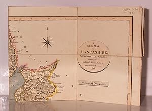
A New Map of Lancashire, Divided into Hundreds, Exhibiting Its Roads, Rivers, Parks &c.
Publicado por London Published by J Cary Engarver & Mapseller Strand Jan, 1818
Librería: Kerr & Sons Booksellers ABA, Cartmel, CMA, Reino Unido
Miembro de asociación: ABA ILAB
Valoración del vendedor:

Folding hand coloured map backed on linen in 15 sections. In full contemporary colour with marbled paper sides folding into a like slipcase measuring 7 x 5 inches. Minor edge wear to slipcase otherwise a very good copy. Scarce.
-

A new map of Piedmont, the duchies of Savoy and Milan; and the Republic of Genoa; with their Subdivisions from the latest authorities.
Publicado por London, printed for J. Cary, Engraver & Map seller, 1799,, 1799
Librería: Harteveld Rare Books Ltd., Fribourg, Suiza
Miembro de asociación: ILAB VEBUKU
Valoración del vendedor:
45.5x51 cm, belle carte gravée et coloriée, grandes marges, 1 Feuille. 53 x 63.5 cm, Please notify before visiting to see a book. Prices are excl. VAT/TVA (only Switzerland) & postage.
-
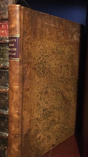
CARY's NEW and CORRECT ENGLISH ATLAS: being a new set of County Maps from actual surveys. Exhibiting all the direct and principal cross roads, cities, towns, and most considerable villages, parks, rivers, navigable canals etc. Preceded by a General Map of South Britain shewing the Connexion of one map with another. Also, a general description of each County, and directions for the junctions of the roads from one County to another.
Publicado por John Carey, London, 1787
Libro Original o primera edición
Hardcover. Condición: Very Good. No Jacket. 1st Edition. The First Edition, First Issue of Cary's innovative Atlas, published on September 1st, 1787 in Very Good condition, the maps themselves being in Fine condition. Folio size hardback in full mottled calf on original boards with professionally replaced spine (compartmented, ruled, with gilt text on maroon leather label). Surface scratches and small indents to surface with what looks like an ink stain to rear board, corners worn but overall smooth and attractive The work on this binding evidently carried out by William George's Sons Ltd., of 89 Park Street, Bristol [tiny binder's/bookseller's label to foot of front inner board].The 47 maps have been collated as all present (Yorkshire merits four maps) and ALL dated September 1st, 1797 - the first issue. All maps have some hand-colouring, chiefly to borders, roads and estates or Parks / woodland. Many tissue guards are present but being made of inferior paper (as usual) they have not fared well and are either creased or ragged or loose (or all three) - they have however more or less done their job in protecting the plates though not without, in a very few cases, some very light off-setting to map borders - though not to the maps themselves. Faint off-settiing to top margin of title page and to a lesser extent the Dedication page, again due to the inferior paper of one leaf. Final half-page of text (Subscribers T to Y) has off-setting from rear board and final blank. The front free end-paper also has by hand, Yapp's name and date. The following blank page has the neatly written name of the antiquary and numismatist, Vernon B. Crowther-Beynon 1894. White, soft, laid paper with statuesque watermark (complete, no name) to a front blank leaf. Apart from the first map "Southern Britain" (England and Wales) appearing on the recto side of the book, all other maps appear on the verso (left) side with the map information opposite. Thus, viewing landscape-orientated maps is made easier with the fore-edge facing downwards. The maps are paginated by hand (no printed pagination except for the text at the rear) in what appears to be neat contemporary hand, also on the alphabetical Contents page. Front non-paginated collation: p[i-ii] Blank, [iii] Title page, [iv] Blank, [v] Dedication [stunning calligraphy], [vi-vii] Blank, [viii] Advertisement, [ix] Contents, [x] 'South Britain' map, [xi-xii] Blank, [xiii] Middlesex map (first County map). Rear text collation: Directions [1]-6, Market Towns [7]-10, Post-Towns [11]-17, Blank [18], List of Subscribers [19]-[24], + 1 Blank.Inside the front board (paste-down end-paper) is the very attractive ex libris of Brunson Yapp (1910-1990), OBE, the distinguished zoologist and author of (for example) Birds in Medieval Manuscripts. A COMPLETE COPY of the work, having importantly, the full List (6pp.) of Subscribers, numbering in total, approximately one thousand and including for each Subscriber, the town or city they were associated with. This List has invaluable information for historical bibliography and was crucial to the very existence of the book of course. How were so many potential Subscribers appraised of the book and how are they distributed across Britain? Also at the rear: Directions for the junctions of the roads of England and Wales through all the Counties. [Six pages covering 52 routes.]; The Market Borough Towns in England and Wales (with distances from London, number of parliamentary representatives; cities and universities];a List of Principal Post and Sub-Post-Towns with their Receiving Houses; and the Subscribers' List. Overall, a handsome copy with far better than average plates and sturdy leather binding. Some additional mailing cost for international insurance fees. Huge 40% PRICE reduction now applied.